The West Pacific
Twin typhoons, Atsani and Goni are spinning in the West Pacific. They were named within hours of each other. |
| Goni on the left, Atsani at peak strength on the right. Image taken 8 19 2015 |
Atsani has been the sronger of the two, developing faster and attaining supertyphoon status on ___ . The storm has since weakened and is undergoing the transition to an extratropical storm in the North Pacific. It has not impacted land and has weakened to a minimal typhoon


16W: Typhoon Goni
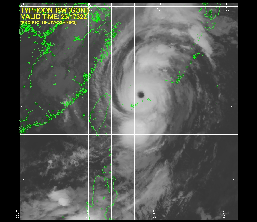
Goni took a more westerly route, heading for the Philippines before making an extremely sharp turn to the north and paralleling Taiwan's coastline. Although the storm's core has not impacted major landmasses yet, the outer bands caused flooding in the Philippines resulting in 10 deaths (source). Goni underwent a major spurt of intensification today to a Category 4 typhoon with winds of 135 MPH before hitting the southernmost islands of Japan.

 |
| The future track of Typhoon Goni goes right between Japan and South Korea |
 |
| Typhoon Goni is a long track typhoon. Note the extremely sharp turn near the Philippines. |
The Central Pacific
03C Tropical Depression Kilo
Kilo
has had issues with organization. Originally forecasted to impact the
western part of the Hawaiian island chain at hurricane strength as it
was hooked north by a abnormally strong trough of low pressure, the
storm is heading west as a weak tropical depression and is forecasted to
stay away from the islands as it turns north. It is forecasted to
strengthen due to unusually warm waters and low shear.

 |
| Satellite Imagery shows modest and disorganized thunderstorms over Kilo |
04C Tropical Storm Loke
Tropical Storm Loke is forecasted to be absorbed by the extratropical remnants of Tropical Storm Atsani. It is forecast to peak as a strong tropical storm and is currently NW of Hawaii and will not affect any land.

 |
| Loke is heading out to sea. TD Kilo is visible at the bottom right of the image. |
The Atlantic Basin
This is sort of the runt of all the basins. The storms here are no match to the monsters in the W Pacific
04L Tropical Storm Danny
Danny, the first Major hurricane of the Atlantic Hurricane Season, has succumbed to high windshear and dry air. It has only disorganized convection displaced NE of it's low level center. The most recent Hurrican Hunter flight failed to find winds supportive of anything more than a Tropical Depression near the LLC. However, computer models have had more enthusiasm with restrengthening this tenacious storm as it tracks through the NE Caribbean.

Danny had overcome dry air to strengthen to a major hurricane but the shear was just too much for him. The storm has stayed south of forecast points for a while so no one's really sure where it's going to go. It it his the islands, the circulation could be destroyed and Danny would be no more. It it somehow stays on water it could restrengthen.Right now, the global models call for the dissipation of Danny.
 |
| Danny at peak strength on August 21 2015 with sustained winds of 115 MPH and a well defined, but tiny, eye |

 |
| Although models depict redevelopment, the official forecast calls for continued weakening and eventual dissipation |
Invest 98L
The next of a line of tropical waves to come of of Africa, It has maintained decent convection and vorticity for a couple of days now and computer models forecast the storm to strengthen possibly to hurricane strength as it passes north of the Caribbean islands. The National Hurricane Center gives it 70% chance of developing into a TD within the next 48 hours and 80% over the next 5 days.
 |
| The red oval is the area 98L is forecasted to develop into a depression. |
 |
| The HWRF model (which did quite well with Danny) forecast for 98L on August 29th calls for the storm to be a strong hurricane north of the Caribbean islands. |
Recent scatterometer passes have indicated that it does not have a completely closed circulation yet although it has TD strength winds. It is also lacking a bit in convection, although not as much as ailing TS Danny.


