Showing posts with label DC Metro. Show all posts

Wednesday, February 22, 2017

Feburary Break is the new Spring Break

Winter may begin on December 1st of the 21st but one thing that meteorologists and the general public agrees is that February is still winter. That being said, February is the end of winter. That being said, I've heard that March is still winter in Ithaca. Well, after a long 3 weeks of second semester, I went back to the tropics of Maryland. Took a trip down to National Arboretum in DC to see spring come a month early. Every day over Break in DC was in the 70s. It was glorious.


The Japanese Apricots (Prunus mume) were in full bloom. They are the earliest blooming of the Prunus genus (cherry, peach, apricot, ect) There are probably hundreds of varieties out there, red pink, white, double, single, you name it. It's such a cute tree but not planted very often.
 The earlier camellias are actually done blooming. They've been lucky not to be wrecked by frosts (as if there have been any).
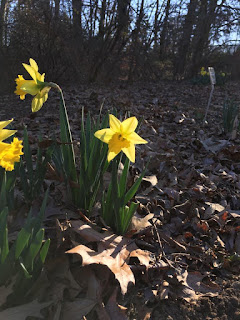


Elsewhere, the traditional spring flowers, Cornelian cherry (Cornus mas), top; Snowdrops on the left, and Daffodils on the right. In other garden news, the famous cherry blossom buds are starting. The peony buds are ready to pop. All they're waiting for is some persistent warmth. The forecast doesn't seem to want to drop temperatures below freezing for a while so the growing season is probably going to start for many plants, especailly those imported from areas less prone to large temperature swings (Asian Magnolias I'm looking at you). If that pans out, let's hope there are no late cold snaps. Otherwise we're going to get some unhappy gardens.

Monday, February 6, 2017

Potential storm Wednesday night into Thurday

I just realized that it is the 7th anniversary of the Feb 2010 blizzards, AKA the best 2 weeks of our lives. Fun times. What I'd give for that again.


It's been a pretty nasty winter across the East for snowlovers. DCA is sitting at 1.4" for the season out of 2 snow events, both in January. Through out the winter, there have been signs of potential improvement in the  models but obviously we have been mislead. No reason to step away from that now. Winter basically never started. Although technically invalid, one could say that we are "due" for a below normal year. Maybe there is a connection. I'll leave that up to the real meteorologists to figure out.

Anyways.... Back to the forecast. After this cutter Tuesday, which should warm us well into the 60s, most of the global models (minus the Canadian) are suggesting that trailing energy will ride up along the front as weak low pressure, bringing precipitation over the area. Verbatim it's a nonevent for the immediate metro. There is a small chance that it will be snow in DC, slightly higher chances the farther north and west you go.  This is what the winter of 2017 has come to.
Forecasted temperatures for Tuesday afternoon
What we would need is for the storm to slow down and allow cold air in ahead of it. We never do well if we depend on cold air to come in on the back side. We also need it to trend a bit farther south. Both are pretty big things to ask for since we are only 3 days out. But considering that the Canadian has absolutely no storm in the same timeframe as all the other models. Who knows, we could get lucky.


CMC (Canadian) model
GFS (American ) model

Monday, October 17, 2016

Warmish week is here.

Yes, it's warm but it probably wont last. It is that time of the Earth's year long orbit when the northern hemisphere is being rotated away from the warm ball of plasma we call the sun. So...
That being said, short term and long term trends are very different things. If Ned Stark were to walk outside today on the East Coast, he'd be like this:
It is pretty warm outside. That's due to an unusually strong high pressure that is now sliding off the SE coast. Its anticyclonic (clockwise) flow is funneling warm air up the eastern seaboard.

These temperature anomalies, however strong, will be short lived. We should go back to normal or even below normal temperatures this coming weekend.Winter is coming or rather the other way around; we are hurtling towards it. The winter solstice is the point of the orbit where the northern hemisphere is tilted the most away from the sun. Hopefully we can make the most of whatever cold we get. Winter forecasts should be coming soon. Brace yourselves...