Sorry about the lull... I was out of town... just got home....
too tired to really do anything...
might get a last second post out tomorrow about the storm...
which is tomorrow...
6-8 inches across the DC metro...
it's no joke folks...
Monday, January 20, 2014

Saturday, January 11, 2014
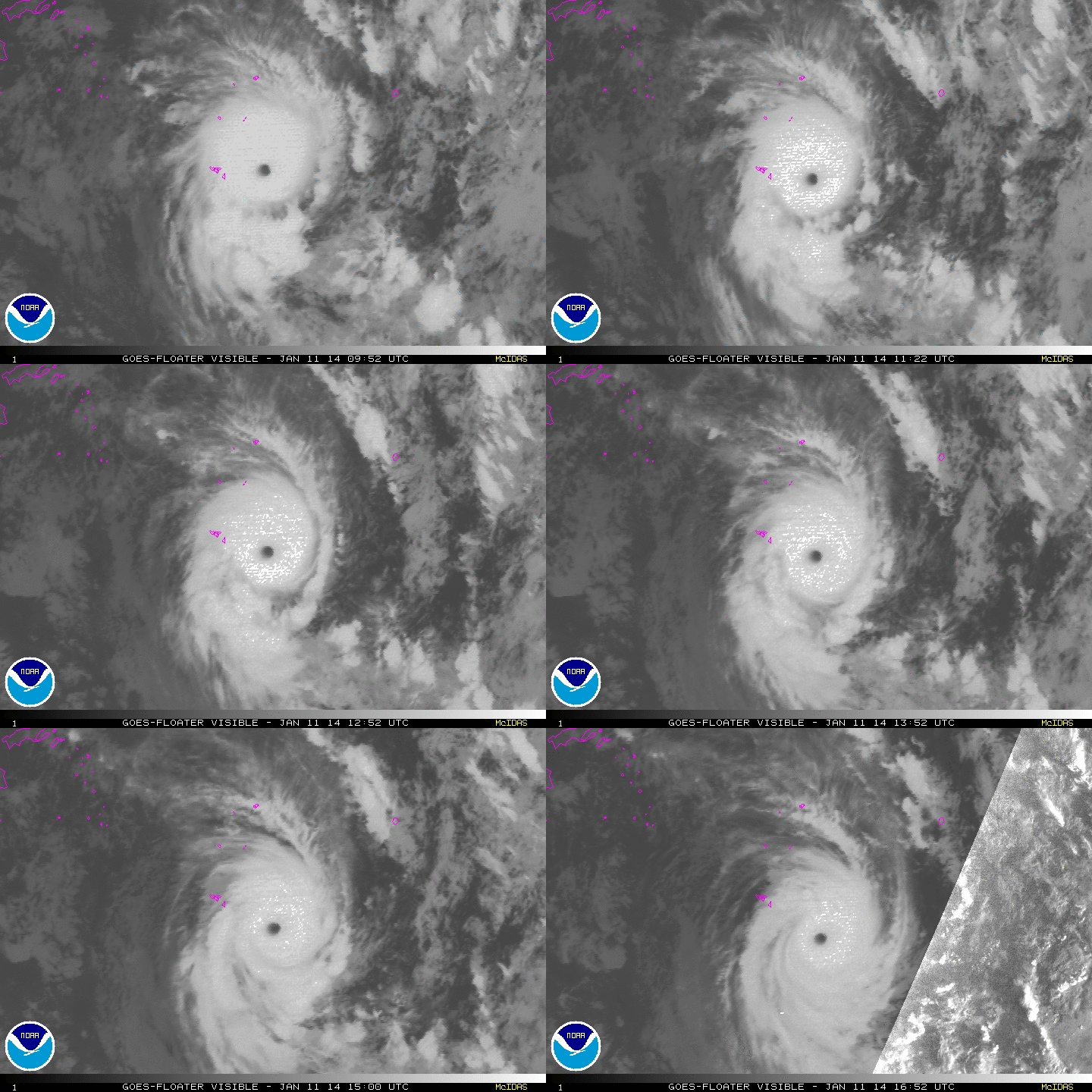
Sunrise over Ian in the South Pacific...
 |
| Sunrise over Ian on 1/11/14 |
 |
| Satellite estimated intensity. Left scale is T# and right scale is the wind speed in knots that corresponds to the T#. The higher the T# the higher the intensity estimate. |
http://www.washingtonpost.com/blogs/capital-weather-gang/wp/2014/01/11/weather-channel-urging-viewers-to-pressure-directv-not-to-drop-network/; http://www.keeptheweatherchannel.com/
Friday, January 10, 2014
Ouch... Cyclone Ian strikes the Polynesian islands
Fiji Meteorological Services
Tropical Cyclone Advisory #24
SEVERE TROPICAL CYCLONE IAN, CATEGORY FOUR (07F)
12:00 PM FST January 11 2014
================================================= ==
At 0:00 AM UTC, Severe Tropical Cyclone Ian (938 hPa) located at 19.5S 174.4W has 10 minute sustained winds of 105 knots. Position good based on hourly multispectral enhanced infrared imagery and peripheral surface reports. The cyclone is reported as moving south southeast at 8 knots.
Hurricane Force Winds
======================
15 NM of the center
Storm Force Winds
==================
30 NM of the center
Gale Force Winds
================
60 NM of the center
Eye well defined on infrared only discernible on visible imagery. Eye warming and cloud tops cooling in past 6 hours. IAN lies in a low sheared environment just south of an upper ridge. Outflow enhanced to the south by jet stream located on the downstream side of the approaching upper trough. Sea surface temperature is around 28C. System is moving south southeastward on the southern periphery of the near-equatorial ridge to the north of the system.
Dvorak analysis based on eye pattern with warming eye in LG surround embedded in W yielding DT=6.0, MET=6.5, and PT=6.0. Final Dvorak intensity based on DT.
Dvorak Intensity: T6.0/6.0/D1.0/24 HRS
Global models agree on a south southeastward movement with gradual weakening.
Forecast and Intensity
========================
12 HRS 20.9S 173.7W - 90 knots (CAT 4)
24 HRS 22.5S 173.2W - 65 knots (CAT 3)
48 HRS 25.9S 172.3W - 50 knots (CAT 2)
Tropical Cyclone Watches/Warning for Tonga Island
=================================================
A Hurricane Warning remains in force for the Va'vau group and Ha'apai group
A Gale Warning remains in force for the Tongatapu group
A Strong Wind Warning remains in force for the rest of Tonga Island
For those who don't understand what the text above is talking about...
Cyclone Ian-Category Four hurricane equivalent storm
10 min avg. sustained winds of 105 knots, 120mph
which translates to about avg. 1 min winds of 135mph
Central pressure: 938 millibars
This storm struck Tonga with winds around 105 mph, uprooting trees and damaging houses.
It is a very small storm, with hurricane winds extending only about 20 miles from the center and gale force winds extending only 70 miles from the center. In contrast, hurricane Irene had tropical storm force winds over a 500 mile swath.
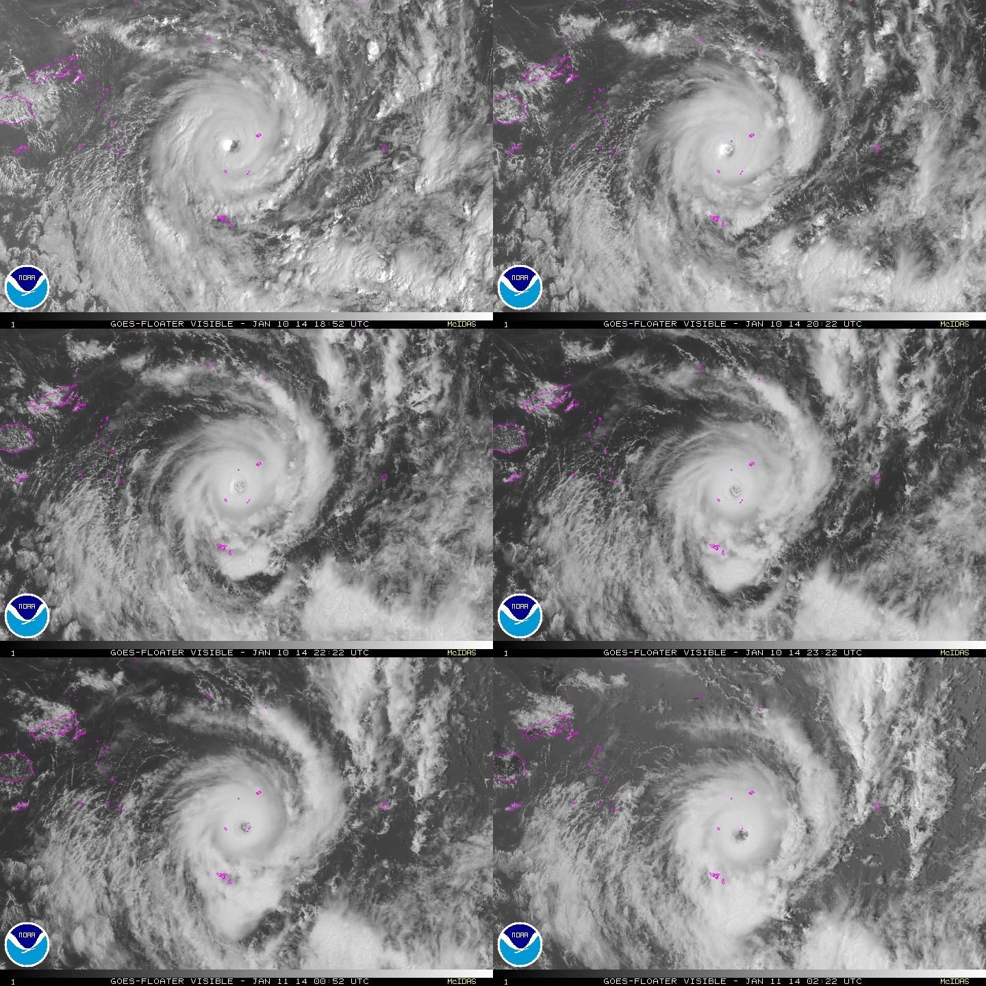 |
| Ian making landfall on an island in the South Pacific 1/10/14 |
+night.gif) |
| Ian at night 1/10-1/11/14 |
Subscribe to:
Posts (Atom)