so is this:
We are talking about the second kind. If you were expecting anything sexy, get out... well the Euro snow maps for 10 days out can be quite beautiful. But those soon become model fails because of the law of snowstorms a week+ out which states that the Euro should have a beautiful Miller a track snowstorm, giving us a foot+ of snow in model la la land, only to turn it into a messy or dead storm as the time progresses.
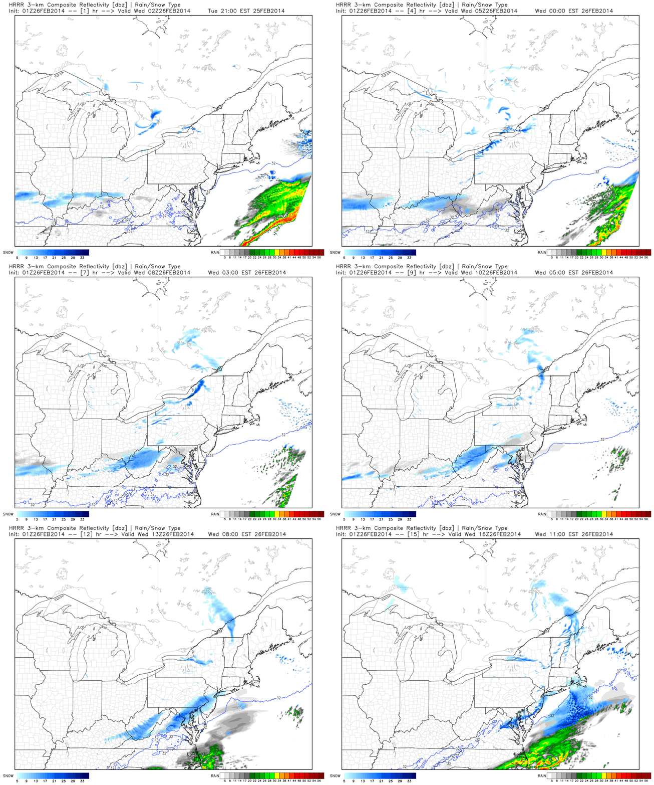
Back to out little snow event. This snow band will be very narrow and small shifts can affect snow totals. All models give us between .1 and .25 inches of liquid. This would translate to between 1 to 2.5 inches of snow using the average 10:1 ratio. However, upper level temperatures will be cold enough to support 15:1 ratios, translating to 1.5-3 inches of snow. Snow should start in the early morning hours and progress through the morning commute before tapering off near 11:00 AM. At this range, we have entered nowcasting.
HRRR
NAM
RGEM
RAP
All of these models paint the most precip across or just north of DC, aka MoCo, therefore, we have a 75% chance of a delay if all goes expected. A concern is that the storm's moisture gets wrung out over the mountains. Another concern is the late start of the snow. Radar will not look very impressive at 4 AM even 5 AM. The snowbank is modeled to form right over us just like today's band. The MoCo peoples might look at the radar and be like pshhhh, all clear, no delay. One thing that may be in our favor was today's overperformance. This may make the county a little more trigger happy and call the delay anyway.
 |
| HRRR simulated radar for tomorrow |
Thanks for reading!
-Alex


No comments:
Post a Comment