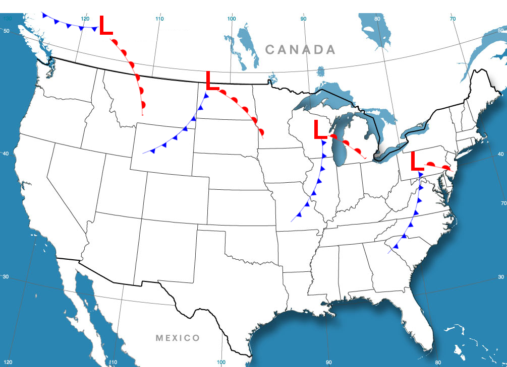
With meteorological winter is halfway through, it seems that the general consensus among snow lovers is that winter so far is lacking. It seems that many of the storms "cut" to the west of us, often timed with the retreat cold air, bringing us a cold rain. Whenever we have the cold, storms are suppressed and the precipitation is unable to reach us. The only victory we have gotten so far is an relatively strong clipper which dropped far enough south to drop us 3-4 inches of cold powdery snow.
 |
| Map of sample clipper track and frontal progression |
There are established correlations between the positioning and strength of various semi-permanent atmospheric features around the world. Two such examples are the Azores High and the Icelandic Low. The North Atlantic Oscillation (NAO) looks at the difference in pressure between these two features. The NAO is correlated to the strength of the westerlies and the jet stream going across the North Atlantic. The NAO forecast is useful for predicting cold outbreaks across the eastern US. The jet stream serves as a fence holding the arctic air back. A negative
NAO index translates to a weakened jet stream which be begins to
meander,dipping near the East Coast, bringing cold air. A positive NAO
goes with a strong jet stream, which keeps the cold hemmed in to the
north.
On a larger scale, the Arctic Oscillation accounts for the strength and therefore, waviness, of the jet stream. NASA climatologist Dr. James E. Hansen explains why the AO is so closely watched. "The degree to which Arctic air penetrates into middle latitudes is
related to the AO index, which is defined by surface atmospheric
pressure patterns. When the AO index is positive, surface pressure is
low in the polar region. This helps the middle latitude jet stream to
blow strongly and consistently from west to east, thus keeping cold
Arctic air locked in the polar region. When the AO index is negative,
there tends to be high pressure in the polar region, weaker zonal winds,
and greater movement of frigid polar air into middle latitudes."
 | ||
| The AO is forecast to go negative for a few days before rising back to neutral. The forecast after a week is uncertain, as evidenced by the model spread. |
Last year, we lacked a negative AO but every time we had a snow event, the AO dropped for that period of time. The dip in the AO this week is accompanied by a chance of a storm.
 |
| The NAO is not forecast to go negative, which shows that it is not likely that there will be any significant storms. |
The pacific jet stream splits into the polar jet and the subtropical jet as it enters North America. Currently, the southern jet stream is dead. Our weather will be dominated by northern stream systems for the foreseeable future. The subtropical jet has been weak for quite a while. Our snow has been coming from northern stream systems. Models seem to be spitting a clipper towards us every 48 hours or so. Most will track to our north though some of them look interesting, dipping into our region. Some also show Miller B coastal storms, which is when a low, such as a clipper develops off the coast. However, due to the small distances between each storm system, we cannot say anything past the first one. Each system is already being affected by the next.
The pattern should be improving for storms as we head towards the end of January. However, this pattern is also very hard to forecast. Nothing will be a lock until the event is within 48 hours. On a lighter note, we have a decent shot at scoring one or two snow events out of this pattern. The next chance is Wednesday. Stay tuned.
No comments:
Post a Comment