Monday, December 22, 2014

Christmas Week Forecast

Hello all, I have returned from the depths of the junior year workload to give you a forecast...

Winter break and the end of the year is fast apporaching. For those who see the winter as a  no-show, (I know you're out there) do not despair, meteorological winter started a month ago. "Winter" started just yesterday. Our best times for snow are yet to come (although I could also be eating my words come spring). For those who are sick of the "cold" already, (we are running 2 degrees above average for the month) spring is only a quarter away, and you will be in for a nice Christmas present.

Summary:
Low pressure intensifies to our west, lifting north towards the Ohio river valley and into Canada, strengthening significantly as it goes, bringing us some rain and warm temperatures. Temperatures will remain chilly tonight in the low to mid 30s, rising into the mid 40s tomorrow will drizzle all day. Rain will continue into Tuesday night and into Wednesday. Lows will be around 40 Tuesday night. Southerly winds on Wednesday will raise temperatures into the 60s before a cold front sweeps through. We dry out Wednesday night with lows in the mid 40s and  Thursday, with highs in near 50. The rest of the week seems pleasant and seasonable with sun and highs in the near 50 and lows in the mid 30s


Active period: Now-12/25/2014
Currently, cold air is still entrenched thanks to CAD from a departing high pressure to the NE. As this high moves away, temperatures will rise as the cold air is scoured away by southerly flow, allowing the warm front to move north. By Wednesday, southerly winds gusting up to 25 mph will develop, bringing a unseasonably warm Christmas Eve, a sort mocking b mother nature.
The low will strengthen rapidly as it pulls to the west into Canada, bottoming out around 970mb, quite strong for a storm. The storm will pull a cold front through the region, possible triggering some convection and heavy showers. Rainfall amounts will be around 1 inch when by the end of the event.


Monday, December 8, 2014

A little ice possible tonight...

Before changing to rain... A cold, depressing, rain...

Today was first real winter-like day of this winter; the snow shower we had today really helped with that. Sadly, once again, it was just a tease. Although the surface temperatures are still cold, southerly flow aloft has brought warm air in.

This is very characteristic of a CAD situation. The cold air stays at the bottom and the warm air overruns the cold. Unfortunately, the high pressure that is supplying the cold air is moving east, and will be replaced with a low pressure system over the great lakes.
Approximate low positions and movement. Red star is Washington DC. Note that the surface winds are still from the north, bringing cold air.
Any precipitation that falls will mostly be liquid. However, where surface temperatures are below freezing, freezing rain and/ or freezing drizzle is possible, forming a glaze of ice on objects that are below freezing. This is not likely to last very long as the cold layer gets shallower and shallower, eventually completely eroding away, allowing freezing rain to become plain rain.
850 mb Temps are above freezing over our area. Winds out of the south at this altitude is responsible for the rise in temperatures. The cold layer is eroding, with a little sliver left up against the mountains.
The 850 mb layer is around 1500 meters in altitude. Generally, if the temperature of the air column is below freezing from 850mb down to the surface, snow will be able to fall. If there is a warm layer that is warm enough to melt the snow between the 850 mb layer and the surface, sleet or freezing rain is possible depending on the altitude of the warm layer.

925 mb temperatures are also above freezing, but just barely. Easterly flow is eroding the cold albeit more slowly.
The 925 mb layer is lower in altitude than the 850 mb layer, around 1000 meters. If temps are below freezing throughout the air column until this point, then liquid will have enough time to freeze and fall as sleet. If the surface is below freezing, but there is a warm layer aloft, then freezing rain falls.

Conclusion:
Don't expect much out of this. The northern third of the county is under a winter weather advisory for sleet and freezing rain. Temperatures will likely be above freezing by morning so no delay expected.

Monday, December 1, 2014

Another Marginal Chance

Probably more like cold rain tho...
Welcome to the first day of meteorological winter, which runs from December 1st to the last day of February. As we know, we torched today. Didn't really feel like spring with highs in the upper 60s to lower 70s across the area. That ends tonight. A cold front has passed through and temperatures have plummeted over 4 degrees an hour and 12 in three hours. Tomorrow will be a cold, raw day, as high pressure to the north drives cold air up against the mountains, a process known as Cold Air Damming (CAD) . Highs will be only in the mid 30s with some chilly wet rawness to boot. 

A weak wave of low pressure is going to ride up the front, which is forecast to be stalled to the south of us tomorrow. As cold air streams in from the north, moisture will stream in from the south. Perfect, right? Not really. The cold layer will be shallow, as per normal  CAD events. So any frozen precipitation will be a mix, likely mainly sleet and rain or sleet and freezing rain, if your surface temperature is below freezing. The surface temperature is even more crucial than the last event because all the cold will be near the surface. Urban and suburban areas will likely stay above freezing, leaving the usual suspects, areas with a location advantage like Damascus etc. to drop below freezing. 

Temperatures will drop to the low 30s by daybreak and only slowly rise during the day into the mid 30s. I'd bank on a cold wet day instead of an icy one. There are many factors that go against the idea of having a icy Tuesday.

Reasons that it won't ice on Tuesday:
  • No cold antecedent airmass in place. We hit 70 today. 
  • The cold air has to be shoved in from the north against the influx of warm air. 
  • The high pressure is moving in tandem with the precipitation so it ends up in a not very ideal position by the end of the event.
  • Weak low pressure may not even throw enough precipitation to amount to much
  • We are not forecast to drop below freezing for the duration of the event (except for those in the far NW of the county)
Well I should to present the other side right...
Reasons why it could ice on Tuesday:
  • Don't underestimate the wedge-cold air is dense and doesn't like to move. Once it is entrenched, we are set.
  • Good strong high pressure to shove the cold air in
  • It's winter
Whoops... Got your hopes up... Let's crush them again... *Whips out the short term Hi-res models*

 This even will be mainly a northwest suburbs event, as depicted by both the High Resolution Rapid Refresh (HRRR) and the Canadian (RGEM). The HRRR doesn't even bring the freezing line far past the Mason Dixon Line for the duration of the event. The CAD signature is obviously there, but the temperatures are too high and the cold too shallow for much frozen precip to fall.


Monday, November 24, 2014

My thoughts on this storm


Thanksgiving Eve Coastal Storm: Nov 24 2014 Update

More Like White Rain or some SnowTV?
The already marginal event is becoming even more marginal. Recent model runs have converged on a solution which puts us right on the rain/snow line. Every little bit matters for us now. Small shifts in temperatures, precipitation duration and intensity, low track, and cold air supply can change our snowfall outlook by a lot. That being said, this looks to be a complicated slop fest, with mostly white rain. Let's break the situation down:
Low track:
We are set with this. Almost track is just a tad west, with the low forming near Wilmington, NC, tracking NNE through the Outer Banks, and up more or less parallel to the East Coast (I-95 Corridor). This is the standard "Miller A" track storm.

 Precipitation:
We have plenty of precipitation due to the vigorous low moving north off the coast. This low will be wrapping in moist air from the Gulf of Mexico. Precipitation amounts between .6 and .9 inches are expected across the area. The precipitation maximum or around an inch is expected to be centered over the I-95 corridor.

Temperatures:
 Surface temperatures is the main (and very complicated)  issue. Our average high for November 26 is 54 degrees. This means we need temperatures to be 20-25 degrees below normal. 
The mid and upper levels of the air column are cold enough for it to snow. Not perfect, but decently cold. However, there will not be a source of very cold air like we usually see in heavy snowstorms. Our blockbuster storms typically have a strong high pressure in Southern Canada, entrenching cold air in the region. Warm air will be on the move out as the storm arrives so a slight increase in speed, as some models have been indicating, would result in the precipitation arriving before the cold air is in place. There is a weak high pressure signature to the north of the region, which means that relatively cold air will be attempting to filter into the region. However, this will likely to be too little too late. With this storm, the infiltration of cold air is not enough; the storm has to manufacture its own through a process called dynamic cooling, where intense lift associated with deepening low pressure cools the air. 
A few degrees will make the difference. Most of the area will start in the low 40s and with some upper 30s in the higher elevations. Temperatures will drop but how far it will drop will be largely elevation dependent. Areas with lower elevation will remain warmer and can expect to get less snow.

 Yes, I realize, I forgot to talk about dynamic cooling again. Will do later. :P

What the NWS says:
HOWEVER...PRECIPITATION IS EXPECTED TO OVERSPREAD THE AREA QUICKLY
EARLY WEDNESDAY MORNING AS THE COASTAL LOW TRACKS NORTHEAST
TOWARD CAPE HATTERAS. THE LOW WILL INTENSIFY AS IT TRACKS
NORTHEAST...AND THIS WILL ALLOW FOR MOISTURE FROM THE ATLANTIC AND
GULF OF MEXICO TO GET WRAPPED INTO THE STORM.
THEREFORE...PRECIPITATION WILL BE MODERATE TO LOCALLY HEAVY AT
TIMES DURING THE DAY WEDNESDAY. THE MAIN QUESTION IS HOW MUCH
COLD AIR WILL WORK ITS WAY INTO THE REGION...CAUSING THE THREAT
FOR SNOW. AS OF NOW...IT APPEARS THAT THERE WILL BE ENOUGH COOLING
FROM THE WET-BULB EFFECT AND DYNAMICAL COOLING FOR ANY RAIN OR
MIXED PRECIPITATION TO QUICKLY CHANGE TO SNOW FOR LOCATIONS NEAR
THE MASON-DIXON LINE AND ALSO NEAR AND WEST OF THE BLUE RIDGE
MOUNTAINS. THE HEAVIEST SNOW ACCUMULATION IS MOST LIKELY TO FALL
IN THE MOUNTAINS...BUT THERE IS A POTENTIAL FOR SEVERAL INCHES OF
SNOW ACROSS MOST OF THESE AREAS SO A WATCH HAS BEEN ISSUED.

FOR LOCATIONS CLOSER TO INTERSTATE 95...THERE MAY BE ENOUGH WARM
AIR FOR PRECIPITATION TO START OUT AS RAIN...BUT EVEN ACROSS THESE
AREAS PRECIPITATION WILL LIKELY CHANGE TO SNOW DUE TO THE COOLING
AFFECTS PREVIOUSLY MENTIONED. HOWEVER...SURFACE TEMPS WILL HOVER
CLOSE TO OR PERHAPS EVEN A COUPLE DEGREES ABOVE FREEZING AND THIS
MAY MAKE IT DIFFICULT FOR SNOW TO STICK. THE HIGHEST DEGREE OF
UNCERTAINTY IS IN THESE AREAS SO PLEASE STAY TUNED TO THE LATEST
FORECASTS FOR UPDATES. FOR LOCATIONS SOUTH AND EAST OF
I-95...MOSTLY RAIN IS EXPECTED...BUT THERE IS A POTENTIAL FOR
SNOW TO MIX IN WEDNESDAY AFTERNOON.

PRECIPITATION WILL END FROM SOUTHWEST TO NORTHEAST LATER WEDNESDAY
AFTERNOON INTO WEDNESDAY EVENING. EXACT TIMING IS STILL UNCERTAIN
BUT THE FORECAST LEANS A BIT TOWARD THE MORE PROGRESSIVE GUIDANCE
SINCE THIS SHOULD BE A FAST MOVING SYSTEM AND IT IS NOT EXPECTED
TO PHASE WITH THE NORTHERN BRANCH UNTIL AFTER IT IS OFF TO OUR
NORTH. TEMPS WILL DIP BELOW FREEZING WEDNESDAY NIGHT AS CONDITIONS
DRY OUT. THEREFORE...ANY WET OR SLUSHY ROADS MAY FREEZE UP.

They show the uncertainty pretty well. (They have a grammaring mistake too)
They seem pessimistic about our chances of it actually sticking much too:
LWX snow map shows a dusting for most of MoCo and up to 3 inches for the people above the fall line.

Conclusion:
The dynamics of the event have not changed much since yesterday apart from a better model consensus and some tweaks to the areas close to the rain snow line ( cough cough us). ... Ok. I guess to us it matters. The main story is that we will be sweating it out on temps. Without the arrival of heavy precipitation, we may not get anything more than white rain. Otherwise, we get SnowTV and if we're lucky, some sloppy accumulation. The potential for this storm to bust on the low (and warm) side is higher than for it to bust high (colder). While we're waiting, lets freak out. 

The Peanut Gallery:

One of the worst case scenarios: March 6th 2013, where we were forecasted to get 10 inches and we 
got like 2.
Jim Cantore standing in a snowless DC
Never Forget: The Snoquester 
If you ever wonder about my thought process: link

Sunday, November 23, 2014

Thanksgiving Week Forecast


After a cold week, a cool weekend, we get a torchy Monday. Is it too early to think of spring?
Summary:
Monday will be cloudy, warm and damp, with periods of rain in the morning. Highs will be in the low 70s. A cold front comes through Monday night dropping temperatures into the mid 40s. Tuesday will be seasonably cool, sunny, with a high in the low 50s. Tuesday night, temperatures drop to the upper 30s and clouds increase as low pressure develops to the south. Wednesday is the wild card day of this week. The coastal low is expected to track north, bringing precipitation in the form or rain and/or snow. In any case, it will likely be a wet and raw day. Temperatures drop again Wednesday night, with a low near 30 and clearing skies. The rest of the week through Sunday will remain mainly sunny and cool, with highs in the low 40s and lows in the mid to upper 20s.
Significant Day: Monday
 A strengthening low pressure system to the west will pull north to the great lakes region over the course of Monday. A warm front will pass over our area, bringing strong southerly winds gusting up to 25 mph tomorrow. Temperatures will shout to be well above average into the low 70s and perhaps approaching the mid 70s in some areas. Rain will mainly be of a showery nature with amounts around a quarter of an inch expected. The main time for rain will be early in the morning on Monday. A cold front will swing through Monday night. This front is expected to stall off the coast, setting up the next event on Wednesday


Significant Day: Wednesday
 A coastal low is expected to track develop off the Southeast coast and track in our direction. Temperatures will be marginal for frozen precipitation but in any case, precipitation is expected to be heavier than on Monday. The current thinking goes that we will start with temperatures int the upper 30s in the morning with some light rain/snow mix developing. Temperatures will drop as the storm strengthens heavier precipitation develops and when the event is set and done, 1-3 inches of snow accumulation is possible. However, this is a very complicated situation so things will change. For better or for worse is yet to be known. Here is the link for a more detailed post: http://mdtropics.blogspot.com/2014/11/thanksgiving-eve-coastal-storm.html


The Omnipresent Question: Will it Snow?
Snow is likely. I repeat, snow is likely. Don't get your hopes up for more than a bit of white slop. But hey, it's November. We barely get a White Christmas, let alone a White Thanksgiving.

Thanksgiving Eve Coastal Storm

So... Snow is possible... how much?
The Setup:
 Snow is expected to fall on Wednesday. How much and how long has yet to be determined. This is quite a marginal setup, requiring us to get many things right in order to get good, sticking in the metro area. Areas to the west probably will have a better time with getting sticking snow due to their elevation. In any case, this storm has the potential to really screw with our Thanksgiving  travel.


Sighs Model Differences:
The computer guidance (models) are still all over the place. The Canadian (GEM/CMC) brings the storm way east and out to sea (OTS) while the European model (ECMWF) brings it just off the coast. Even the similar models, the GFS and the Parallel GFS, have vastly different solutions. The main difference beween the GFS and the P-GFS is  that the P-GFS has higher resolution. They both run on the same physics principles. The main issue is the difficulty in resolving the strength of the coastal low. For example, the Euro brings the storm west because it amps it up a lot off the coast, which keeps us a bit on the warm side. The P-GFS depicts a scenario where there is a low over the Great Lakes, which disrupts our developing coastal system. the Operation GFS is similar to the Euro, which lends credence to the more amped solution, which is more ideal for us. One issue that all models show for us is surface temperature issues. Our temperatures will likely start near 40, dropping with the onset of heavier precipitation. Since there is a lack of true cold air near the storm, the storm will have to manufacture its own cold air through a process called dynamic cooling.
A comparison between the Operational GFS and the P-GFS

In Conclusion:
While we have a pretty decent chance at some accumulating snow, we still can have some improvement  to the scenario. The setup isn't perfect; the lack of a truly cold airmass to our NW is worrying. We are currently dependent on heavy precipitation to save the day although there are signs that high pressure may develop to the north, injecting cold air into the storm. Otherwise, we could just get white rain or plain rain, with no accumulation. Th most likely scenario is rain/snow in the morning changing to snow with 1-3 inches of accumulation in the metro area and 2-5 as you go towards the more rural areas to the north and west.

Sunday, November 16, 2014

Week of 11/16/2014 Forecast: Cool then Frigid

Winter's has arrived. No doubt about it. Although our normal highs are still around 60. We may not even pass thirty degrees as a high on Tuesday. It's cold.

Summary:
Rainy and cool Monday with highs around 50,  then clearing out Monday night as an arctic cold front drops through with lows dropping to the upper 20s. Tuesday will be sunny but with moderate westerly winds as highs struggle to reach freezing. Lows in the low 20s to upper teens on Tuesday night. Wednesday-Saturday: Sunny and clouds, chilly, moderating to the 40s by the end of the week, lows in the mid to upper 20s.

Details:
Significant days: Monday and Tuesday
 A cold raw rain is expected tonight as a strung out area of low pressure approaches from the southwest. This low will "cut" to the west of us, bringing warm southerly winds. Tomorrow will also be rainy but it will be quite mild compared to the day after with peaking near 50 by early afternoon prior to the frontal passage. Rain amounts between 1-1.5 inches is expected. Temperatures will begin to drop after 1 PM as cold air advects in. Winds will increase to around 15 mph overnight as the temperature drops to the upper 20s Monday night. 

Winds will increase to 20mph on Tuesday, gusting to around 30. It will be a sunny, but blustery and cold day. We have a chance of breaking the daily minimum high temperature record for all 3 airports (BWI, DCS, and IAD) on Tuesday as highs struggle to pass freezing. Areas in the northern part of the county likely will not pass 30 degrees. Temperatures at night will plummet to the low twenties in the urban heat island and the teens in the outer suburbs, also threatening to set record lows. Tuesday will be the coldest day since late March of 2014.
Temperature overview for the next 3 days according to the 21 ensembles of the SREF model. Black line is the mean. The more closely clustered the lines are, the higher the confidence in the forecast.
The rest of the week will be quiet. On Wednesday, will once again be sunny and cold, with highs in the low to mid thirties. Winds will die down as the low pressure pulls away. after that, the temperature will moderate in response to retreating high pressure. Despite this, they will stay well below normal. with highs approaching the mid 40s by Thursday,  with a slight cool down after that.

Any Snow?
For those who do not want to have hope and have it crushed: No.

For those who will hang on to hope till the storm has passed (like me): Maybe...
Snow outlook will come out tomorrow if  time warrants.

Thanks for reading~
-Alex

Thursday, November 13, 2014

First Snowflakes tonight

6:50 PM 11/13/2014
Rain snow mix (more rain than snow at the moment) has broken out across the area. This is expected to transition over to sleet and  briefly snow before ending tonight. No major effects are predicted and no accumulation is expected either, due to warm ground and air temperatures. We may get a temporary whitening of grassy and elevated areas during heavier precipitation though nothing lasting is expected. This is nothing major, just a little bit of moisture strung out along a front. i will update after piano lessons if necessary.

Enjoy the first snow of the season~
Alex

Monday, October 13, 2014

AL08 Gonzalo

http://www.ssd.noaa.gov/PS/TROP/floaters/08L/imagery/avn-animated.gif
The most current satellite loop of Gonzalo (Updates Automatically)
10/16/2014 Update:
Hurricane Gonzalo peaked again this afternoon as a Category 4 storm with 145 mph winds and a central pressure of 940 millibars. This is the strongest hurricane in the Atlantic since Hurricane Ophelia in 2011. Bermuda is now in for a very close or direct hit from a major hurricane tomorrow. Fortunately, Gonzalo is undergoing another eyewall replacement cycle, which make result in some weakening. In addition, increasing shear and cooling sea surface temperatures should contribute to weakening.  This being said, microwave imagery and recon has indicated that the outer eyewall is closed, which means there is an eyewall ready to take the place of the collapsing inner one. The storm may not weaken very much tonight before impacting Bermuda, which is under a hurricane warning. The effects of Gonzalo on Bermuda are expected to be similar to Hurricane Fabian of 2003, one of the most destructive hurricanes to hit Bermuda. Gonzalo is forecast to have 130 mph winds at its closest approach while Fabian had 120 mph winds.
Microwave image of Gonzalo showing large and well organized outer eyewall depicted by a ring of red. The remnants of the collapsing inner eyewall is the yellow splotch inside the NE portion of the eye.

IR loop of Category 4 Hurricane Gonzalo during late morning.

10/15/2014 Update:
11:00 PM EDT
Gonzalo seems to have completed the EWRC and is beginning to pop out an eye again. The storm has weakened modestly to a 120 mph storm and can be expected to resume strengthening shortly.
Gonzalo popping out an eye

Microwave image showing the eye of Gonzalo in terms of  water clouds from convection.

8:00 PM EDT
Gonzalo strengthened to a category 4 hurricane with winds around 130 mph this morning. As reconnaissance aircraft was investigating the storm, they noted that the hurricane had concentric eyewalls on the plane's radar. By the time they left, the inner eyewall had contracted and the eye was just 5 miles in diameter. Soon after, the eye clouded over and  Gonzalo underwent an eyewall replacement cycle (EWRC), where the inner eyewall collapses and a new one typically takes its place. As a result the storm was downgraded to a category 3 hurricane with 125 mph winds. Over today, the eye has been largely clouded over and convection has been weaker than it had been previously, possibly due to dry air entrainment during the EWRC, which is often an issue. But recently, there has been a blowup of convection on the west side of the storm, indicating that a strengthening process may begin anew as large scale environment remains favorable.
The eye of Hurricane Gonzalo clouding over this morning as it begins undergoing an EWRC. At the time, Hurricane Gonzalo was a category 4 Hurricane with 130 mph winds.

IR loop showing the blowup of cold cloud tops (red and grayish silver)  associated with strong convection on the west side of Hurricane Gonzalo around 7:15 PM. At the time, Hurricane Gonzalo was a category 3 hurricane with 125 mph winds
The official forecast brings Gonzalo just to the west of Bermuda still as a major hurricane before sending it east of Newfoundland as a strong cat 1 hurricane transitioning to a extratropical storm. It is extremely unlikely that Gonzalo will directly affect the US mainland because a strong low pressure system (which brought us all the rain today) will push it out as it moves east.
An IR satellite image showing a well defined and strong low pressure system and cold associated cold front draped across the East Coast, which will move east, "hooking" Hurricane Gonzalo, causing it to recurve NNE past Bermuda and into the Northern Atlantic.

10/14/2014 Update:
BULLETIN
HURRICANE GONZALO ADVISORY NUMBER  10
NWS NATIONAL HURRICANE CENTER MIAMI FL       AL082014
500 PM AST TUE OCT 14 2014

...GONZALO BECOMES A MAJOR HURRICANE OVER THE OPEN ATLANTIC...
...ADDITIONAL STRENGTHENING EXPECTED...


SUMMARY OF 500 PM AST...2100 UTC...INFORMATION
----------------------------------------------
LOCATION...21.2N 66.0W
ABOUT 330 MI...530 KM E OF GRAND TURK ISLAND
ABOUT 770 MI...1240 KM S OF BERMUDA
MAXIMUM SUSTAINED WINDS...115 MPH...185 KM/H
PRESENT MOVEMENT...NW OR 320 DEGREES AT 13 MPH...20 KM/H
MINIMUM CENTRAL PRESSURE...970 MB...28.64 INCHES 

Hurricane Gonzalo strengthened to a major hurricane today while pulling away from Puerto Rico. It is expected to strengthen further to a category 4 hurricane. It likely will affect Bermuda as a weakening borderline major hurricane (winds of around 115 mph) and may later make landfall on Newfoundland with forecasted winds of 100 mph.

Satellite loops show that Gonzalo has developed a small eye and has very intense convection wrapping around eye, especially the eastern side. The eye has been steadily shrinking and Gonzalo may undergo a eyewall replacement cycle soon.

10/13/2014 Update:
For those of you who like color,a colorize infrared loop of Gonzalo. The redder the colder the cloud tops, which indicate strong convection.

Ir loop of Gonzalo, starting out as an area of disorganized thunderstorms well east of the Lesser Antilles before organizing and strengthening into a Tropical Storm.

Radar loop out of Martinique of Gonzalo organizing as it approaches and ultimately impacts the Leeward Islands. Note how a partial eyewall develops near the end of the loop. This as well as developing spiral (curved) bands of precipitation is a sign of strengthening.


ORIGINAL TEXT:
An area of low pressure originating from an African tropical wave that had been designated Tropical Storm Gonzalo a day ago has quickly strengthened. Winds around 75 mph were measured by reconnaissance aircraft in the storm. In addition, recon found a partial eyewall that is open to the south. Therefore, as of 4:00 PM EDT (5:00 AST), Gonzalo is officially the 7th named storm and the 6th hurricane of the season.

From the NHC:
BULLETIN
HURRICANE GONZALO ADVISORY NUMBER   6
NWS NATIONAL HURRICANE CENTER MIAMI FL       AL082014
500 PM AST MON OCT 13 2014

...GONZALO BECOMES A HURRICANE WHILE MOVING THROUGH THE
NORTHERN LEEWARD ISLANDS...
...ADDITIONAL STRENGTHENING LIKELY...


SUMMARY OF 500 PM AST...2100 UTC...INFORMATION
----------------------------------------------
LOCATION...17.9N 62.9W
ABOUT 20 MI...30 KM SE OF ST. MARTIN
ABOUT 140 MI...230 KM ESE OF ST. THOMAS
MAXIMUM SUSTAINED WINDS...75 MPH...120 KM/H
PRESENT MOVEMENT...NW OR 305 DEGREES AT 12 MPH...19 KM/H
MINIMUM CENTRAL PRESSURE...984 MB...29.06 INCHES
 
Gonzalo is currently battering the northern islands of the the Lesser Antilles in the Caribbean. Unverified reports of sustained winds of 76 mph and gusts up to 125 mph have been reported on the Island of Saint Barts island, which was struck by the western eyewall. Gonzalo is expected to begin to turn to the north, as a trough of low pressure over the US progresses east. While Gonzalo moves towards Bermuda, it is forecast to strengthen into a major hurricane with 115 mph winds before weakening as it approaches Bermuda.
Official NHC forecast graphic
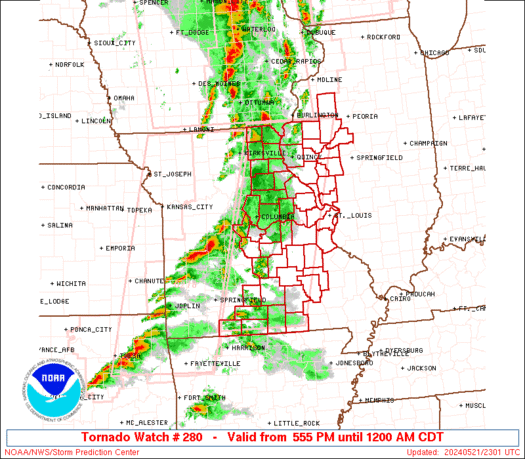
Fortunately (or unfortunately for some) Gonzalo will not affect the US directly. You can thank the low pressure system that's producing tornadoes over the south for steering him out to sea. The same low pressure will also bring rain on Wednesday.


Tuesday, October 7, 2014

Super-Typhoon Vongfong

10/09/2014 Update:
Super-Typhoon Vongfong has weakened, although it is still packing quite a punch, with max sustained winds around 150 mph according to the 18z (2:00 PM EDT) Joint Typhoon Warning center update. Vongfong has begun its turn and is going almost due north, taking aim on Japan and associated islands. Okinawa island, one of the southernmost islands and home to the Kadena Airbase, is forecasted to get a glancing hit as the typhoon passes to its east. Vongfong will weaken as sea surface temperatures drop and shear increases and is expected to complete its transition to an extratropical storm (a low pressure system with fronts [really it's more complicated than that but this definition works well enough]) over northern Japan.
JTWC Forecast Graphic 10/09/2014 Vongfong is expected to landfall in Japan as a hurricane.

Microwave imagery shows that Vongfong has developed concentric eyewalls(rings of strong convection and precipitation) indicating a eyewall replacement cycle(EWRC) is occurring. As the inner eyewall collapses, the typhoon will weaken but may restrengthen if the outer eyewall is sufficiently well organized and contracts to replace the original eyewall.
Super Typhoon Vongfong on October 9th at 1:32PM Eastern Time. Notice the erosion of the northern periphery of the cloud pattern. This may indicate dry air intrusion, disrupting convection.


For those who want the know the background on the name Vongfong, it is a name contributed to the name list of typhoons in the West Pacific basin. Macau (Macao) a semi autonomous region of Southern  China, close to Hong Kong contributed this name. The name means "wasp" , probably in Cantonese, since the two main languages spoken are cantonese and chinese but the chinese word pinyin wasp is huang feng, similar but not the same as Vongfong.

Super Typhoon Vongfong as seen by Astonaut Reid Wiseman from the International Space Station at 7 am EDT October 9, 2014. Image credit: Reid Wiseman; and also: Dr. Jeff Masters;
ORIGINAL TEXT:
After a bout of rapid intensification, Vongfong achieved Super-Typhoon status, being upgraded to having estimated sustained winds of 180 mph and gusts up to 220 mph.

Super Typhoon Vongfong as seen in moonlight at 17:03 UTC (1:03 pm EDT) on October 7, 2014. At the time, Vongfong was a Category 5 storm with 180 mph winds. Image credit: Dan Lindsey, NOAA/NASA and RAMMB/CIRA.


Sunrise over Vongfong on October 8th 2014. Note the Stadium effect on the eye, which makes it seem larger than it actually is. Image courtesy of CMISS/University of Wisconsin

This is the strongest tropical cyclone since Super-Typhoon Haiyan late last year, which had estimated sustained winds of up to 195 mph. It struck the Philippines with estimated sustained winds of 190 mph.

Super Typhoon Vongfong
Super Typhoon Haiyan at peak right before landfall


Vongfong is not expected to hit land at full intensity. It is forecase to turn north from its current west heading, strengthening a little to 190 mph before weakening  as it recurves. Likewise to Typhoon Phanfone, earlier this week, Vongfong is forecast to strike Japan while weakening though it may still be a major typhoon when it crosses over some of the outer islands of Japan.
JTWC official warning graphic beginning October 7th

Tuesday, September 2, 2014

Mango seedlings :D


Mangoes are awesome. But some mangoes are better than others. The most commonly sold mangoes in the US are the red and green Tommy Atkins mangoes. They're not valued for their taste, but for their ability to be stored and shipped for long distances and arriving at the supermarket somewhat mango-like. They're fibrous and often not very sweet. It's like playing the lottery on mangoes some are ok and others are downright atrocious. You can do better than these. go to and tropical country and the first mango you pick up will likely taste better. Another type is the Ataulfo mango, or Champagne mango. It is smaller and less fibrous and reputable sweeter, but once again, cannot compare to mangoes in tropical countries.
Ataulfo on the left and Tommy Atkins on the right
The mango that closes resembles those from tropical countries in terms of flavor and sweetness so far (My tropical fruit experience stems from Taiwan) is the Francique mango from Haiti. We found a few this year at whole foods and decided to try them. Even the lime green ones were sweet. Out of curiosity, I did some research on planting mango seeds. I decided on the method that called for split open the husks and placing the seed into a bag with moist paper towels.


Poly embryonic mango seedling

Francique Mango

 Tangle of roots and paper towels that the mangoes called home for a month.


 All the mango seedlings in a group photo after extraction from the paper towel the largest seedling (left photo) would be among the 2 survivors after squirrels decided to eat the rest
                                 

Wednesday, June 11, 2014

Tornado Watch until 9PM

The SPC has issued a tornado watch until 9PM for the Washington DC metro area and areas to the NW. Currently,  a backdoor cold front ( west progressing cold front) is near the vicinity of Baltimore. To its South and West, southerly flow at the surface has brought warm, moist air up, creating an unstable environment to fuel the storms. Soundings have indicated around 2000-2500 J/kg of CAPE and around 30 knots of shear. The CAPE is enough to support severe thunderstorms. Shear may be a little weak but is forecast to strengthen. Shear is strongest near the front. As the storm nears the boundary, the wind shift associated with it creates shear, this promotes turning of the the storm and increases the chances of tornadoes. However, this is delicate balance. As soon as the storm crosses the front, its source of energy is gone and the storm chokes itself to death. Where is the front is is very hard to forecast, hence the short notice. This is also a reason past scenarios have failed to produce tornadoes. Another reason include lack of surface heating and destabilization due to persistent cloud cover. Updates will come as needed and if I can find time (unlikely) away from schoolwork(very likely).

OFFICIAL SPC WATCH AND PROBABILITIES
WW0280 Radar
THE NWS STORM PREDICTION CENTER HAS ISSUED A

   * TORNADO WATCH FOR PORTIONS OF 
     DISTRICT OF COLUMBIA
     WESTERN AND CENTRAL MARYLAND
     SOUTHWEST AND SOUTH-CENTRAL PENNSYLVANIA
     NORTHERN VIRGINIA
     NORTHERN AND EASTERN WEST VIRGINIA
     COASTAL WATERS

   * EFFECTIVE THIS WEDNESDAY AFTERNOON AND EVENING FROM 300 PM
     UNTIL 900 PM EDT.

   * PRIMARY THREATS INCLUDE...
     A COUPLE TORNADOES POSSIBLE
     ISOLATED DAMAGING WIND GUSTS TO 70 MPH POSSIBLE
     ISOLATED LARGE HAIL EVENTS TO 1.5 INCHES IN DIAMETER POSSIBLE

   THE TORNADO WATCH AREA IS APPROXIMATELY ALONG AND 55 STATUTE
   MILES NORTH AND SOUTH OF A LINE FROM 20 MILES SOUTHWEST OF
   PITTSBURGH PENNSYLVANIA TO 50 MILES SOUTHEAST OF HAGERSTOWN
   MARYLAND.  FOR A COMPLETE DEPICTION OF THE WATCH SEE THE
   ASSOCIATED WATCH OUTLINE UPDATE (WOUS64 KWNS WOU0).

   PRECAUTIONARY/PREPAREDNESS ACTIONS...

   REMEMBER...A TORNADO WATCH MEANS CONDITIONS ARE FAVORABLE FOR
   TORNADOES AND SEVERE THUNDERSTORMS IN AND CLOSE TO THE WATCH
   AREA. PERSONS IN THESE AREAS SHOULD BE ON THE LOOKOUT FOR
   THREATENING WEATHER CONDITIONS AND LISTEN FOR LATER STATEMENTS
   AND POSSIBLE WARNINGS.

Tornadoes
Probability of 2 or more tornadoes 
Mod (40%)
Probability of 1 or more strong (F2-F5) tornadoes
Low (20%)
Wind
Probability of 10 or more severe wind events
Mod (30%)
Probability of 1 or more wind events > 65 knots
Low (10%)
Hail
Probability of 10 or more severe hail events
Mod (30%)
Probability of 1 or more hailstones > 2 inches
Low (10%)
Combined Severe Hail/Wind
Probability of 6 or more combined severe hail/wind events
High (70%)

Sunday, April 27, 2014

First PDS tornado Watch of the season... We have arrived at Spring...

8:30 PM UPDATE
Tornado emergency for areas just north of Little Rock Arkansas

Look at that hook echo, indicative of a strong tornado. The pink area is likely where debris being thrown up by the tornado is. The tornado is likely somewhere near the debris ball. The storm developed extremely rapidly in a few minutes.


Later scan below:


ORIGINAL TEXT:
The SPC has issued our first PDS tornado watch for S Arkansas ahead of a cold front associated with a cutoff low that will be slowly traversing the US this week. High dewpoints in the upper 60s and temps in the 80s along with with a degrading cap will allow storms to take off while a favorable upper level environment with shear will keep the updraft separate from the downdraft, allowing updrafts to persist and begin spinning.

Particularly Dangerous Situation (PDS) Tornado Watch 100


WW0100 Probability


SEL0

   URGENT - IMMEDIATE BROADCAST REQUESTED
   TORNADO WATCH NUMBER 100
   NWS STORM PREDICTION CENTER NORMAN OK
   335 PM CDT SUN APR 27 2014

   THE NWS STORM PREDICTION CENTER HAS ISSUED A

   * TORNADO WATCH FOR PORTIONS OF 
     SOUTHWEST AND CENTRAL ARKANSAS
     EXTREME SOUTHEAST OKLAHOMA

   * EFFECTIVE THIS SUNDAY AFTERNOON AND EVENING FROM 335 PM UNTIL
     1100 PM CDT.

   ...THIS IS A PARTICULARLY DANGEROUS SITUATION...

   * PRIMARY THREATS INCLUDE...
     NUMEROUS TORNADOES EXPECTED WITH A FEW INTENSE TORNADOES LIKELY
     WIDESPREAD LARGE HAIL AND ISOLATED VERY LARGE HAIL EVENTS TO 2.5
       INCHES IN DIAMETER LIKELY
     SCATTERED DAMAGING WINDS AND ISOLATED SIGNIFICANT GUSTS TO 80
       MPH POSSIBLE

   THE TORNADO WATCH AREA IS APPROXIMATELY ALONG AND 65 STATUTE
   MILES NORTH AND SOUTH OF A LINE FROM 30 MILES NORTH OF DE QUEEN
   ARKANSAS TO 50 MILES EAST NORTHEAST OF PINE BLUFF ARKANSAS.  FOR
   A COMPLETE DEPICTION OF THE WATCH SEE THE ASSOCIATED WATCH
   OUTLINE UPDATE (WOUS64 KWNS WOU0).

   PRECAUTIONARY/PREPAREDNESS ACTIONS...

   REMEMBER...A TORNADO WATCH MEANS CONDITIONS ARE FAVORABLE FOR
   TORNADOES AND SEVERE THUNDERSTORMS IN AND CLOSE TO THE WATCH
   AREA. PERSONS IN THESE AREAS SHOULD BE ON THE LOOKOUT FOR
   THREATENING WEATHER CONDITIONS AND LISTEN FOR LATER STATEMENTS
   AND POSSIBLE WARNINGS.

   &&

   OTHER WATCH INFORMATION...CONTINUE...WW 95...WW 96...WW 97...WW
   98...WW 99...

   DISCUSSION...DISCRETE STORMS ARE BEGINNING TO DEVELOP ALONG THE
   DRYLINE NEAR THE RED RIVER IN SE OK...WHILE OTHER CONVECTION IS
   EXPECTED TO DEVELOP FARTHER S IN NE TX THE REMAINDER OF THE
   AFTERNOON.  THESE STORMS WILL MOVE ENEWD INTO THE WARM SECTOR AND
   MATURE...AND WILL ENCOUNTER AN INCREASINGLY FAVORABLE ENVIRONMENT
   FOR TORNADOES IN AR.  LOW-LEVEL SHEAR IS VERY STRONG ALONG A
   RESIDUAL OUTFLOW BOUNDARY ACROSS CENTRAL AR...AND THE LOW LEVELS
   WILL SLOWLY WARM AND MOISTEN IN THE WAKE OF EARLIER CONVECTION. 
   DISCRETE SUPERCELLS MOVING INTO THIS ENVIRONMENT WILL HAVE THE
   POTENTIAL TO PRODUCE LONG TRACK...STRONG/VIOLENT TORNADOES WELL INTO
   THE EVENING.

   AVIATION...TORNADOES AND A FEW SEVERE THUNDERSTORMS WITH HAIL
   SURFACE AND ALOFT TO 2.5 INCHES. EXTREME TURBULENCE AND SURFACE
   WIND GUSTS TO 70 KNOTS. A FEW CUMULONIMBI WITH MAXIMUM TOPS TO
   550. MEAN STORM MOTION VECTOR 24035.

Monday, April 14, 2014

Adkjsfkdjs... Freeze possible....

Strong southerly flow ahead of an approaching storm system pushed the temperature up to 80 at DCA (Reagan nat'l airport) today. Despite our late spring like weather for the past week, we are still at risk for frosts and freezes. The average last freeze for the area is April 15th. Planting of tender plants is not recommended most years until late April. we have been in for quite a roller coaster ride for the past few years. Spring 2012 featured the warmest spring on record, with the growing season starting in late march. 2013 had a prolonged cool period, and this year it seems like we flipped the switch from March to April. We went from 34 and snow on March 31st to 65 and sunny the day after and we have gradually warmed ever since. The cherry blossoms have bloomed, trees have budded, the pollen count has spiked, and even the grass needs to be mowed but that being said, winter just refuses to die. Pretty sure I've said that more than once.

Now once again, spring will display its bipolar tendency and swing another cold front our way. Tomorrow, our high will be in the morning and temperatures will drop throughout the day as cold air rushes in from the west following a cold front passage. Sounds familiar, right?  Showers and possibly thunderstorms will accompany this front as temperatures drop into the 50s during the day and down near 30 by Wednesday morning. That 30 degree temperature forecast is concerning because the growing season has begun. Steps need to be taken to protect tender plants from the freeze. The NWS has issued a freeze watch, meaning that there is a decent possibility of a damaging freeze.


In addition to the freeze, models show the possibility of a little bit of backside rain/snow/ice mix of the non accumulating type as cold air rushes in, meeting with lingering moisture. However, models do vary on the amount and precip-type. Some show weak waves of low pressure riding up the front, which would focus more life and moisture, producing more precip while others show a straight frontal passage, with no low pressure waves.  Here is a quick rundown of the models:

EURO:


The Euro is warm and wet, with no snow for us. Temperatures stay in the mid to upper 30s as the cold air struggles to get over the mountains.


GFS:


The GFS is the coldest and snowiest of the models, simulating .1-.2 inches of liquid equivalent frozen precip for the area. That would translate to at most, an inch of snow on elevated surfaces if taken verbatim. The temperatures depicted are record lows for those dates. Compare the temperatures with the Euro, which has a higher grid resolution. The Euro is 5-10 degrees warmer. Taking the warm ground temps and some logic, you can assume that the GFS is too cold. Downsloping would either wring out the all the moisture against the mountains, giving us dry cold  or it could warm the air through compression or it could do both. In a way, areas farther east have a better chance of getting snow because they have a better shot at getting residual moisture after the front passes.


NAM:

The NAM keeps snow well to the north and west of us. It basically highlights the issues discussed above about the GFS, drying us out fast, and keeping us warm.


CMC:

The CMC strikes a balance between the GFS and the NAM, keeping the snow right along the fall line where elevation would help with the cooling. It is much more believable than the GFS.


SREF:


The Short Range Ensemble Members model gives us a mean of .23 inches of snow. However, out of the 22 members of this model suite, only 7 members give us any snow. The mean is .23 inches but chances are we will get nothing.

In any case, any accumulation is very unlikely if not impossible. There may not even be any frozen precip because the models tend to bring cold air over the mountains too quickly when compared to observations. Downsloping is our enemy. Modeling is still an imperfect science, it is to be taken as guidance, not the say all end all to forecasting. so the recommended course of action is to wait and see. Preparations should be made to protect tender plants that have been planted out or better yet, wait until may to plant tender plants.

Thanks for reading!
-Alex