The storm setup does not favor snow, in fact, if not for our geography, we would probably just be getting rain. The mountains to the west allow for cool air to pool in a phenomenon called Cold air damming (CAD)
Why not snow?
Simply put, the primary low will track to our west, drawing warm air on its east side north. we usually get snow when we are on the west side of the storm while the east side gets rain. We will be on the arm side of the storm. So why are we still getting wintry mix? Because of CAD
Cold Air Damming
High pressure to the north pumps cold air into the Mid Atlantic Region. This air jams up against the Appalachian mountains, creating an extension of the high pressure along the Appalachian mountains .When a storm system arrives from the west, warm air overruns the cold, producing precip. Initially, the cold and dry air mass would cause any precipitation to evaporate, lowering the temperature of the air column through evaporative cooling, but eventually, precip will reach the ground. If the airmass is cold enough, the preip would be frozen. Below is a graphic drawn from the 00z CMC run, which demonstrates the cold air damming. The black arrows denote air flow from the arctic high to our north and the yellow lines show the isobars, which denotes a certain air pressure. Notice how a tongue of high pressure extends into the Mid Atlantic. Since the cold wedge is driven up against the mountains, precipitation over WV is in the form of rain as the warm air advects (travels) northwards with the low.

The precipitation should start out as a little snow. As the warm air intrudes into the cold airmass at upper levels, the snow melts then refreezes forming sleet. As the warm air increasingly erodes the cold air, only a surface layer of cold air remains because warm air is less dense so it rises. Eventually, the cold air loses as a new low also forms to the east of the high pressure tongue. As a result, the cold northerly flow is cut off and replaced with warmer southerly and easterly flow.
The rate at which the cold air erodes is a major issue when forecasting. An difference of a degree or two could result in vastly different scenarios. Computer models tend not to do well with CAD events due to their low resolution. The NAM should handle the CAD better because of it's higher grid resolution.
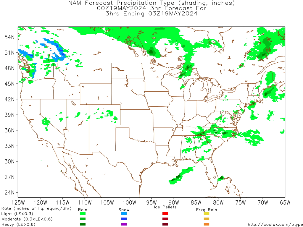
NAM
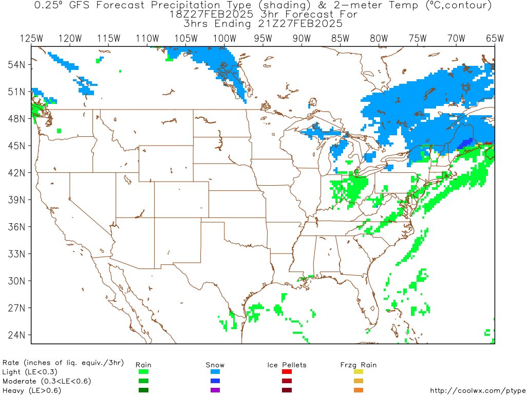
GFS
Thanks for reading,
Alex