Sunday 9:30 AM Update:
It snowed last night but then it all melted because we were 3 degrees above freezing. Areas just to the East of us will do much better due to elevation. Also there seems to be something about the topography that doesnt like Ithaca. Look at the Ithaca split on radar.

Still going with 3-6 inches total accumulation. Hopefully the bands will move around once we transition completely to Lake Effect Snow.
Saturday 7:44 AM Update:
We are still a go for snow. Models have generally converged to us getting around a half a foot of snow. Some will be lost to melting so accumulations will be lower. We are now in the range of multiple high resolution short range models. However, the event duration is too long for these models to cover the entire event. So we shall look at the 4 km resolution NAM again. You can see the lower totals over the finger lakes. This is both due to lower elevation and the moderating effect of the lake. Even then, Ithaca proper is forecasted to get 5 inches by the model. Let's see how much being 500ft above the lake helps us. It'll be a beautiful day for a bit. Enjoy it.
ORIGINAL TEXT
It might hit 70 tomorrow. And then 6 hours later it could be snowing. Time to bring up the memes again.
Tomorrow will be a nice late spring day. Temperatures will hit the mid to upper 60s by mid afternoo, possibly 70 thanks to a nice southerly breeze. By mid afternoon (3-4 pm), a strong cold front will be knocking on our doorstep. As the rain starts, temperatures will rapidly drop, as much as 20 degrees during the first hour as temperatures aloft crash. Depending on how fast the surface cools, rain could change over to a period of wet snow, after 9pm Saturday and continuing into the early morning hours.
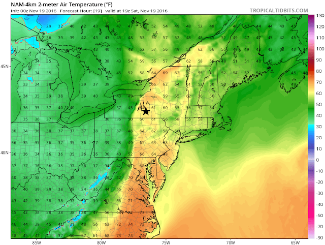 |
| 4km Resolution NAM depiction of temperatures across the Northeast at 2PM on Saturday. The front is about an hour out from Ithaca (black star) By 4PM, it is near 40. |
Then a lull is expected as the synoptic scale activity and the lake effect/upslope snow machine cranks up Sunday morning. This situation is unique in that there is a large pool of cold air aloft associated with a strong upper level low (ULL) passing overhead Sunday. The cold air aloft makes it easier for the relatively warm air near the surface to rise (instability). In addition, the lower levels of the atmosphere will be moistened by relatively warm air being injected by the surface low pressure to our NE. This creates a ripe environment for multiple lake effect bands to develop unusually far away from the lake.
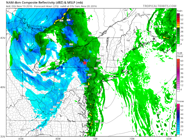 |
| 4km NAM showing a changeover to snow around 8PM. Typically, temperatures lag a bit compared to models so the changeover probably will be closer to 9 PM. This is still subject to change. |
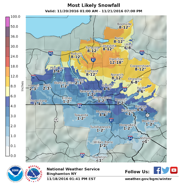
Since we are dealing with smaller scale bands, exact snow amounts are hard to predict and can range a lot over short distances but snowfall will be more widespread than usual due to the instability and moisture. Snowfall amounts will be greatest oh the hills directly to the south of Lake Ontario and Erie, with 8-12 inches of snow expected.
In Ithaca proper, 2-3 inches of snow is forecasted by the NWS. On
Cornell's campus, I expect
4-6 inches of snow since we are at a higher elevation. Snow amounts can easily exceed that if we are stuck under a snow band for a couple of hours, which I think is a possibility. It can also be under the forecast if the bands miss us. At that point it's not forecasting, it's nowcasting.
 |
| If you zoom in reeeeeally close, you can see the tight gradient between downtown and the hills we are on just east of downtown. Goes from 2-3 to 4-6 inches. |
Winds after the front will initially be out of the NW at 20-25mph with gusts to 35mph Sunday dropping to the 10-15 mph range on Monday and Tuesday. Temperatures will be around freezing Sunday morning before dropping into the upper 20s Sunday night and mid 20s Monday night. Windchills could feel like the upper teens at times. Most of the snow should fall Sunday afternoon into Monday morning before diminishing into flurries by Tuesday morning. After Tuesday, it will be sunny and temperatures will begin a slow rebound before another system approaches late week. The impacts of that storm remains to be seen.
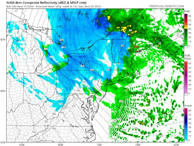 |
| 4km NAM showing lake effect bands with areas of upslope/ ULL enhanced snow. |
This is just a summary of the situation for this weekend. There are too many things to write about here in detail-how topography affects snow amounts, why the lake effect bands even make it here, thundersnow potential, snow ratios,ect. In any case, if you like snow, yay! join the club. If not, at least it's not very cold and break is soon. Updates will be posted to this post so check back for them.
Thanks for reading!
-Alex


