Sunday, September 3, 2017

Irmagerd, don't panic yet

While Harvey was wreaking havoc on Texas, a tropical wave just off the coast of Africa quietly spun into a tropical storm named Irma. The next day, it became a hurricane, and by the end of that day, a major hurricane, the easternmost Major Hurricane to form in August and the 4th easternmost anytime of the year.

Hurricane Irma satellite imagery http://tropic.ssec.wisc.edu/#
Computer models have been hinting that Irma could affect the US since Irma's birth. Although climatologically, such a strong storm so far out is favored to go harmlessly out to sea, Irma's track is unusual, forced west by strong high pressure. It's also the infamous "I" storm, which have been quite damaging in recent years. Of the 16 "I" storms since 2001, 8 of them have been retired. Interestingly, Irma was selected to replace Irene, which impacted the East Coast in 2011. Storms are retired when the reuse of the name would cause confusion or panic, generally since they have cause major damage.
Retired hurricanes with names staring with "I" since 2001 (Credit: weather.com)
What we know:
Irma is expected to move WSW over the next 3 days as it approaches the Lesser Antilles (beginning of the Caribbean) before beginning a turn to the WNW. All models have the turn happening early enough that Irma will scrape across the northern islands without entering the Caribbean Sea. However, since the sea temps are warmer there, the storm will also get stronger. Right now the National Hurricane Center predicts a Category 4, but a Category 5 hurricane is not out of the question and has been forecasted by nearly every model (including the GFS and ECMWF). As Irma heads west, its direction should turn more northerly, potentially affecting the Bahamas and other landmasses.
Official NHC Forecast issued 11PM EDT, September 2 2017
What is to be seen:
We have little idea about which piece(s) of land will be affected in the longer term. Any potential US landfall is more than a week away, somewhere around September 10th or 11th. Computer models are pretty accurate within 5 days so nailing something 9-10 days away would be an absolute miracle so I'm just going to leave them out for now.  Currently, it seems that the East Coast of the US is going to feel some effect from Irma. Whether it's just a scrape or a full blown landfall is another story.

Either way, it may be wise to review disaster plans and stock up on some essentials such as water and non-perishable foods. Just in case. I will keep you posted.


Sunday, May 7, 2017

I hate lawns

Poaceae, the grass family is perhaps the most successful family of plants on earth. Under natural processes, grasslands cover 20-40% of the land surface. In addition, they have managed to make themselves indispensable to the continued growth of the most successful primate species, humans. Six of the top 7 agricultural plants are grasses, including corn, wheat, rice, and barley.We harvested 672 million hectares of grass food crops accounting for 5% of the world's landmass. In comparison, we currently use 11% of the world's land for food production. This is perhaps the most extreme and successful example of mutual coevolution. The plant offers nutrition in exchange for protection and spread.

The grass family is diverse, with species being able to survive from the arctic tundra to the steamy tropics. Grasses tolerate burning, repeated trampling, flooding, grazing, you name it. They are troopers. Just ask the crabgrass in the sidewalk cracks, yet without our help, they would be mostly confined to areas not hospitable to other, typically larger and woodier plants like trees. Mind you the Great Plains, the Siberian Steppes, and the Serengeti account for a pretty large area of the world's land surface. However, in areas with more rainfall or less fires, trees can grow and shade out the grasses. One can say our crops are using us to terraform earth for their needs. Our ability to feed the world comes at the expense of millions of acres of trees and other ecosystems. We have even altered the grasslands themselves. There are only fragments of unplowed prairies, threatening many wildflowers and animals such as Leopold's Silphiums.

Then come the urban areas. There's still grass everywhere in the form of lawns. 80% of yards have a lawn. A lush green lawn evokes the affluence of the European manors that first started the practice of a purely ornamental lawn. Previously short cut grass was maintained by livestock grazing. This crop, with a 40 billion dollar industry around it, is purely decorative and a epic waste. We literally pour rivers into keeping grass green in desert regions. We pollute the air with 2 cycle lawnmowers and the water with pesticides. We poison the entire ecosystem by maintaining the monoculture in the name of the American Way. Grass is boring and wasteful. I find a lawn laced with wildflowers even if it was just violets and dandelions to be much more attractive. My yard is never fertilized or sprayed and every year, more grass is converted into garden space. It's lower maintenence and can serve purposes like vegetable production or runoff collection.  It's sort of like how the Creating an Urban Eden class built the bio-swales along Tower Road instead of installing a strip of grass that would have to be replanted yearly.

Maintaining a good-looking monoculture is a never ending drain on resources and time. That's why golf courses are so expensive. It's actually very unhealthy. To keep a lawn green, it has to be in constant growth, which is susceptible to diseases and pests. In addition, the monoculture is like an all you can eat buffet for the pests. The perpetual dead spots near the sidewalk are a combination of trampling and harsh temperature swings. Believe it or not, it's not the winter salt that kills grass but the freeze thaw cycles. On a sunny cold day, the concrete can be 30-40 degrees warmer than the air temperature, melting the soil, but as soon as the sun goes down, the temperature plummets and the grass freezes. Dr. Frank Rossi, who is Cornell's turfgrass specialist conducted research that showed this.

In short, the American Lawn has to die. It's simply not sustainable and there are better things to do with the limited space in urban areas. Even an unmowed wildflower meadow would be able to harbor beneficial insects and wildlife. Or one could make use of the land and grow food. The goal is to improve the urban ecosystem, not continue poisoning the land.

Saturday, May 6, 2017

Wildlife

I was so caught up with plants I almost forgot that wildlife exists. I don't know why I prefer plants over animals but I do care about the well-being of both. I think it's nice that we have found a way to live with all the resident wildlife on campus. Then again, the diversity isn't exactly great from what I've seen. I bet the urban life deoesn't suit many species but others, like squirrels, are adaptable and thrive. 
Dickson's resident skunk

Caution! chipmunk
The animals here are so used to people's presence that half the time they act as if you don't exist. The other day I was wandering along the lake when I realized that I had stepped over a goose nest. Completely unguarded, with no goose in sight. It it were DC, I would've gotten pecked to death long ago. The geese here in a way are nice they let you pass instead of the other way around. I wonder how that happened.

Heron and a Canadian Goose
Goose nest
The wildlife is more than just for viewing pleasure. They are a part of the ecosystem. Squirrels and chipmunks hoard away seeds underground, which then sprout regenerating forests. However annoying it is to have hundreds of oak seedling pop up in your flowerbeds, the planting is a valuable ecosystem service to the forests. They also help clean up the ecosystem. Scavengers like vultures clean up carrion, which prevent disease spread. We have a responsibility to allow these cycles to happen to the best of our ability. It's also logical to. Ecosystem services are invaluable to us , yet many times we don't realize it.
Vultures ( I saw them up close but didn't get a photo)


Saturday, April 29, 2017

The Norway Maple

The Norway Maple (Acer platanoides) is one of the earliest trees to flower in the NE. It's clusters of chartreuse flowers signals the beginning of spring. Introduced to the US in 1756, it quickly became a popular street tree for its ability to tolerate adverse conditions. On the other hand, the native Sugar Maple is famously (among gardeners) unable to tolerate disturbance to roots, heat, and drought, associated with life in urban areas. Many other native trees like the American Elm, Ash, and American Chestnut were killed by diseases hitchhiking over on plant from Europe. To replace the rapidly dying canopy, trees like the Norway Maple were planted. The Norway Maple made itself at home in the NE and quickly began to spread outside of gardens and cities. However, at the time, much of the land was being farmed so its opportunity to invade forests was lessened because there were no forests to invade.
Norway Maple flowers
 Plains and elsewhere, Farmland was abandoned en masse and allowed to revert back to forest. In the past, Eastern Hemlock (Tsuga canadensis), Sugar Maple (Acer saccharum), and Red Oaks (Quercus rubra) would be the dominant species in a climax forest. However, the Norway Maple had many advantages. For example, its root system is thick and fibrous, allowing it to literally suck the life out of the soil, as anyone who has tried to grow a lawn under one of these trees can attest. In addition, any plants that managed to grab a foothold under the tree would be shaded out by the Norway maple's wide leaves. The fact that it is one of the earliest trees to leaf out also helps. Its ability to out compete many trees also allows it to suppress the understory. There is simply not much that can grow under a Norway maple. Interestingly, to me these characteristics would be a dealbreaker for an ornamental tree not to mention that it often girdles itself in cramped environments, that it, strangle itself to death with its roots, but I guess some people want a carefree tree.
 
Norway maples often establish pure stands, especially near areas disturbed by humans. In the more far flung areas, there are isolated specimens, but something has kept them from establishing themselves. Either they physically did not spread there or they may have already died out since their lifespans generally under 100 years as the secondary growth forest grows. Either way, it is considered an invasive species for its ability to displace native plants in disturbed sites.

I don't have anything against introduced species coexisting with native species but as some of the introduced species, like Norway Maples push other plants out, then they become a problem. Even in their native habitat, they do not form monocultures since there are diseases and other plants that keep them in check, which are not present in the US. These species should be dealt with accordingly, ideally by extirpation. However,  the attitudinal fix of education probably won't work, especially when the tree is mainly planted in urban areas where people can't see its effects. A technical fix would be creating a sterile variety that can;t reproduce. But there are certainly breeding populations out there already and those would need to be eliminated. The structural fix of banning the sale of them, which has been done in some states like Wisconsin and Illinois, where the invasion has been worse, but the sale of the Norway Maple in New York is still legal and only regulated in a way that intentional introduction into the wild is illegal. The Norway Maple is probably one of the oldest invasive species in the US, and like almost all the other ones, was introduced as a ornamental or agricultural plant with an intended use. The list of problems the cause goes on and on. It also goes to show that some actions intended to fix problems can create more problems than they are worth.

Sunday, April 16, 2017

I like trees Part II

Wow I really ran off on a tangent over there on the last post. As humans, we seem to appreciate things that are bigger and older than us, like trees. They have seen and been through more than any of us, and yet they stand there unmovingly, silent. Something about their branches upstretched towards the sky. They are the epitome of the religious sublime and just enduring grandeur in general.  I really do love trees and I am saddened by their destruction by disease, as well as by human activity. Growing up in a neighborhood undergoing redevelopment in a rapidly developing suburb of DC, I have seen more than my fair share of trees, often older than the houses they stand by go down and be replaced by new McMansions or entire forests be replaced by a new subdivision. It seems that in the buzz of growth and prosperity, we have forgotten what literally constructs the country-trees.  Sometimes us treehuggers secure a victory, such as when urban planners decided to build metro tracks to curve around the oldest tree in my county at an estimated 299 years old. Even then, it's bounded by a 6 lane road on one side, and a freeway on another and if it wasn't the oldest tree, it would have been ground to mulch.
The Linden Oak, a White Oak, with the metro tracks in the background

In comparison, the oldest tree on campus here at Cornell is also an White Oak, with an estimated age of 350 years old. It is located on Libe slope near Gannet.
Image may contain: tree, sky, snow, plant, house, outdoor and nature
Cornell's oldest tree
In the arboretums, I saw this oak, a Red Oak, which is actually much larger than the Libe Slope oak. However, I could not find any information on the age of the tree or the circumstances of its existence. I have observed trees from all walks of life so I could probably make a guess. Based on its low branching, it probably grew in a full sun and exposed environment. The tree didn't have to grow upwards and compete for light as it would in a forest. It's also meant it had no use as lumber. It was also probably spared the fate of being plowed over since it grew at the transition between a flat area useful for farming into a rather steep hill. The area to the left is still being used as research fields today. As the trees grew in around it, the oak was forced to reach up for the light again, which is why many of the horizontal branches abruptly turn upwards. These limbs died back to a limb that had access to the sun. The wounds from these large dead branches will probably be the downfall of the tree though, as rot progresses down the branches and hollows out the trunk, the horizontal branches might overload, leading to collapse. Cornell seems to see the tree as a risk, which is why it is roped off. It's also pretty good for the tree if we don't tread on its rootzone.


I wouldn't be surprised if this majestic oak has been here for longer than Cornell has been around. Let's see, 1865 founding... 152 years... So if that tree is older than 150 years than it's older than Cornell. Maybe, but without a core we will never find out. Or maybe we don;t hear about it because it's not the oldest or the biggest (also on Libe Slope). It's a shame that people often only care about the superlatives. The way I see it, a 100 year old oak still deserves respect. Don't kill it by stupidly digging a trench 15 feet from the trunk for a septic line. Even a sapling is something precious. The majority of seeds produced don't even get to sprout. We should share the land with the trees that inhabit it. They hold memories of the past (in the rings and branches) and are inn fact living things. In any case, this majestic tree that is lucky to not be located in any land desirable for development (like that poor Fernow oak).  May it have many years of life ahead.


Saturday, April 15, 2017

I like trees

Today I wandered into another part of campus I've been meaning to go to since I got here but never found the time to. I went to the F.R. Newman Arboretum. An arboretum is a collection of trees only, although generally the have woody shrubs and underplantings of herbaceous plants. Many arboretums were created as a way to display trees and shrubs that grow in the climate and region the arboretum is located. I have liked trees for as long as I can remember. The first picture I drew was a tree and even though I like plants in general, I love trees above all. The arboretum is where I am at home.

Seems like a lot of grass. Room for expansion.
I wandered through the grove of nut trees by Fall Creek (Another place I want to go through). The road followed a ridge  where on the left was the wooded valley leading into Fall Creek and on the right were the managed plantings of the arboretum. The woods are probably second growth forest from when the area was logged, based on the fact that the slope is probably too steep for farming. The area has an canopy of Sugar Maple, Oak, and American Beech, with an understory of young hemlocks, which will one day make up the climax forest given enough time.

Woodland vs managed plantings
But these forests will never be the same as before we logged them. The entire ecological system is different and is still changing. Generally, we tend to focus on the negatives with the assumption that the past what is desired. With environmental restoration, we strive for the pure and untouched ecosystem that predates human settlement. We call unlogged forests "virgin" growth. Hoewever even these tracts have been changed, probably irreversibly. Introduced species and diseases are changing the forests. Not that they haven't been for hundreds of years.


On the left of the previous photo, one can see a tree with bright gray bark. This is the venerable American Beech, one of the dominant trees of NE forests. It probably won't remain so for very long. Around 1890, the insect, beech scale was introduced to Nova Scotia. The beech scale sucks the sap of beech trees and the wounds are a open path for a fungi Nectria coccinea var. faginata to enter and infect the tree. In an effort to stop the infection, the tree kills off tissue surrounding the infection site, causing sunken cankers in the bark. Since there are many infection sites, the cankers cut off nutrient and energy flow between the leaves and the roots and the top of the tree dies. By 1932, the disease had spread into Maine and since then it has continued its slow march south,. The infection front is currently in Pennsylvania. Many of the beeches in the Ithaca area show signs of of infection, and this one is no exception. The normally smooth bark is pockmarked by cankers. Tree mortality stands at 30-50%, with many of the survivors being damaged and susceptible to other stressors. Unfortunately, there is no treatment for either the fungus or scale. Trees that are infected can also regenerate from root sprouts although these are quickly infected too and do not gain much size.

To add insult to injury, someone has carved things into this specific tree. Beeches are favored for "X was here" carvings due to their smooth bark. In the past, this may have had been simply a cosmetic injury to the tree, but since the beech scale finds shelter in these rough cuts, this makes the trees more susceptible to the disease. Sadly, either way, this tree was probably going to go out someday. The bright side is that there are resistant trees that seem to be able to prevent scale infestation and therefore the fungus invasion. Although it may seem counterproductive, it is recommended to kill any infected trees that resprout. This would allow the resistant trees to proliferate and decrease reservoirs for disease. It is my hope that we will be able to develop resistant varieties of not just beeches, but also other trees that once populated our forests that have been killed off by disease. I would also love to be able to contribute to the effort as a plant scientist.

Saturday, April 8, 2017

March: Winter came and left again

Winter came back in March with a vengance culminating in the snowstorm mid march. A big shoutout to mid range computer models that insisted on a cold period during this month.
March actually had fewer days above 60 degrees than Feburary. 2 in March compared to 5 in February. March's average temperature of 28.0F was a full 4.6 degrees lower than the February average of 32.6. It was even lower than the January average of 28.9. I'm too lazy to go look at December but March was probably warmer than then too because temperatures typically bottom out in late January. Not that it has been a normal 2 years by any means. In anycase, by the end of the month, snow was just a distant memory.
March Temperatures were largely normal to below normal

While the plants apart from spring bulbs were all asleep, areas farther south did not fare well with the early start to the growing season and then winter's return. Cherry blossoms in DC were covered with ice during the snowstorm that impacted there and here. With the increasingly volatile temperature swings, early warmth followed by damaging freezes will probably become more common across the US. People should probably stay away from early blooming plants like ornamental cherries and magnolias or at least select later blooming varieties. Even later blooming plants like Apple trees are at risk of freeze damage as shown by the recent spring freezes which have been disruptive to the local apple industry.

Thursday, March 30, 2017

Spring ami(d)st

The weather is driven by the movement and transfer of energy, embodied in the form of low pressure systems. There, warm air surges northward with the warm front ahead the storm and cold air dives south behind it to be warmed again. At this time of the year, the warm is slowly winning the seasonal battle, driving further and further north. Yes, the cold fights back but any gain is soon lost. That's not to say it doesn't put up a fight. On Tuesday, we were able to witness the transition in action in the form of dense fog.


Around noon, very dense fog suddenly developed, shrouding the campus in a ghostly mist. Warm air can hold more water vapor than cold air. This warm air cooled as it contacted the cooler air at the surface since cold air is dense and therefore hard to dislodge. When the air cannot hold any more water vapor, it condenses into liquid, and suddenly the water is visible. This process generally happens high in the atmosphere, forming clouds. Fog is basically a ground level cloud. Normally, air cools as one increases in altitude. In the case of fog temperatures near the surface are cooler than the upper levels. This is called an inversion. This often happens in valleys where the mountains physically prevent warm winds from mixing the cold air out. This results in the weird thing where one can stand on the summit of a mountain in the sun but meanwhile the valley below is cool and foggy. This could have been the case since we are located on the slope of an ancient glacial valley. In this case, another explanation could be that a cold front was pressing in from the North, feeding cold, dry air, which was being channeled down the valley. This dry air eventually caused the fog to dissipate (evaporate). While the cold won out this time, its victory won't last long. Eventually the warmth will win out.

Monday, March 27, 2017

Well this tree fell, not sure if it made a sound...

Why do peoplc care if a falling tree made a noise? One should be asking why the tree fell in the first place.  What I found interesting about this tree was that it fell with no warning, on a calm day. There was no way one could predict the failure of the tree. However, upon further analysis there are several factors that could have led to the failure of the tree.

Upon examining the rootball (or lack thereof), it's obvious that this once handsome red oak suffered from major root issues. Instead of uprooting which is characteristic of trees that still have some semblance of a healthy root system, every root just snapped.

Let's have a closer look. Clearly this tree has been having some issues for a while. The white substance is fungus. Whether it was pathogenic or was just an opportunistic fungus is hard to determine. It it no doubt contributed to the decline in the structural integrity of the roots.
Another contributing factor could be the the severe drought that we had last year. Since trees are such large organisms, they respond on a longer timescale. In short, it takes longer for them to show stress or die. The drought could have stressed the tree and the wet winter allowed for the roots to rot out enough for the tree to fall. Another possible factor is recent road construction. If one looks back at the first photo, the pavement closest to the tree is darker which means that it is newer. What happened under the pavement is unknown but if they did any digging it would have affected the tree. Fortunately this tree fell on a closed road at a quiet part of the day, only causing damage to the wooden railing. Although this tree has fallen, it is my hope that another one will be able to take advantage of the hole in the canopy. Normally, the fallen tree would be home to insects and animals for decades as it decays but seeing that it is blocking a road, it probably will be removed soon.


Sunday, March 26, 2017

Wildlife at Cornell: Big Red the red-tailed hawk

The other day I came out of plant science to go to dinner like any other day and while I was unlocking my bike noticed a man standing 50 feet alone behind me looking up at the plant science building and seemed to be talking to someone else. Slightly perplexed, I hopped on my bike, glanced back to the building and seeing nothing amiss, prepared to leave. I didn't get far before finding a woman also staring at the building from another vantage point. Turns out that they were looking a red-tailed hawk perched on top of plant science. She told me that her name was Big Red, that her mate (Ezra) had recently passed away, and that she had not been seen on the Ag quad for a while although her nest was nearby. After a few minutes of admiring the bird perched calmly on the roof, I was on my way back to the hubbub of a freshman dining hall. 
Here's an incredibly high quality photo of Big Red surveying the Ag Quad on top of Plant Science.

In this urban environment, most of the animals have adapted to life in proximity to humans and Big Red is no different. Her nest is located on Fernow Hall, as opposed to a tree in a more "natural" setting. Human activities have opened up nearby woodlands giving her places to hunt the healthy squirrel and rabbit population that is no doubt benefiting off our activities such as the lush lawns and food scraps. In a way the wildlife here is not even truly wild; they have all experienced the human hand in some way. We watch Big Red's nest with webcams. Ezra was euthanized after being brought in with a severe wing fracture and identified by his tag number. What we have here are the organisms that can tolerate or take advantage of the changes that we bring about.
Big Red back at her nest courtesy of the Cornell Lab of Orinthology's Cornell Hawks twitter account.

Saturday, March 18, 2017

An adventure through the snowstorm

Oh how I love snow. There's just nothing better than wandering through feet of snow as dendrites the size of half dollars pour out of the sky. Well that didn't quite happen but it came close. Anyways it's kind of hard to play in the snow if you can't walk and you can't see. I learned that in the 2010 snowstorms back in DC.

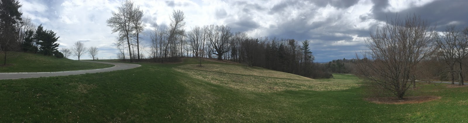
After classes were cancelled (of course after all my classes had let out already), I went sledding with friends and romping through the forest. From the hills beyond North Campus, I watched Cornell disappear into a shroud of snow.
Cornell's campus is somewhere back there I swear
At one point, night fell and since Wednesday had not been cancelled yet, went back to do work. Later that night, I got bored of work and decided to go for a walk in the blustery winter wonderland. Needless to say, trudging through 2-3ft snowdrifts was not easy. And to think that 2 weeks ago it had been pushing 70. Some of the early spring ephemerals had come out, especially in warmer microclimates around buildings. These were now buried under a protecting layer of snow. It's actually better than an exposed freeze. I've had plants freeze down to the snowline instead of the ground because snow is so insulating. That's why igloos work. Snow is great
You don't say...
Wind is the sculptor of snow. It brings the snow to life, swirling and drifting to form exquisite shapes. This is, however, not without the help of objects around it. Trees seem to sink into the ground and ripples flow across the paths.
Maybe it would be easier to just sled...


The solid barriers of buildings often create turbulence of on the lee side, scouring and depositing snow, creating unique twisted snowdrifts. This is why permeable windbreaks like trees work far better than walls. They slow the wind instead of deflect it. The drifts below were particularly eye-catching because they were. backlit by lights on the stairs between Roberts and Kennedy Hall.

Just above the stairs, the wind tunnel created by the buildings stripped all the snow away. Likewise, in exposed areas, the powdery was often stripped down to a couple of inches by the winds, even to bare ground at times. Cornell also kept the roads surprisingly open, probably with a ton of salt, which is an ecological issue in of itself. If only they could keep the sidewalks open too.

Central Campus at 1:30AM
The real reason I cam out was because I had spotted a lake effect band forming over Cayuga Lake and it meant business when it finally arrived. It was also almost 2:00AM and there were still people sledding down Libe slope, seemingly into a cloud of snowflakes. I presume this is why travel bans are a thing. It was really hard to see anything and it was cold so I went back...
Where's West?
Morrill Hall


In terms of snowfall, the blowing and drifting in addition to the localized nature of the snow bands made it hard to determine the snowfall amounts. An NWS employee measured 17.4" 1 mile NE of Ithaca, which would place it near Cornell's campus. Downtown Ithaca reported 14.7". Both reports were as the storm was winding down, but not yet completely over. Binghamton reported 31" of snow, breaking their all time storm total from the blizzard of 1993.First verified Winter Storm Warning since 2015. Let's see how the snowmelt goes in the March sun. With the big storms, warmups tend to come quickly after the storm. Overall, it was a pretty exciting storm. A big one for upstate NY definitely. But frankly, I do not expect that anything will beat the back to back blizzards in DC anytime soon in terms of raw power. I'd bet that those would also shut Cornell down for a week too.

Wednesday, March 15, 2017

March Monster

Look at the size of this beast of a storm. Its moisture feed stretches well into the Gulf of Mexico while it snows in upstate NY. This shows how weather connects the world's ecosystems. Water transpired by Caribbean plants are transported into the NE US to build snowpack, replenish rivers and aquifers, sustaining plant and animal communities up there too. And every once in a while, it gives Cornellians a day off.


Monday, March 13, 2017

Stating the obvious: Dont travel in a snowstorm

From the Binghamton NWS: "The CIPS analog system produces the Valentines day 2007 storm as the number one analog, and the 1993 superstorm as number 2. Both of these storms produced widespread 1 to 2 foot accumulations across our area with localized areas of 30+ inches."

Guess what... Cornell closed for both storms... Ithaca got 30" (all time record) in 1993 and 18" in 2007...

However, this time the warnings only suggest 10-18" inches of snow but the upside is much higher, in excess of 2 feet. Also the timing of the storm is bad, beginning early in the morning and going throughout the day. People might come to school but then may not be able to get back. I feel like this is a nightmare in the making. Of course the lower amounts could verify. We shall see....

Gametime for DC: March 13-14 Snow/Sleet/Freezing Rain/Rain Currfest

Finally have time to sit down and write. Well we finally clawed our way to a winter storm-in March no less. With only a few hours before the start of precipitation, details are still being worked out. The overall synoptics are clear. Low pressure currently over the Midwest will transfer energy into a developing coastal low off the SE coast. This consolidating low will then run up the East Coast, bringing widespread heavy precipitation. This in conjunction with abnormally cold air will result in frozen precipitation for many.
Current storm positions and radar
First stop for the storm is DC.

Precipitation will overspread the region somewhere between 8PM and 10PM tonight. It may begin as light rain but will turn to snow as steadier precipitation develops. In the early morning hours, as the storm cranks up and approaches, the immediate DC metro area should mix with sleet. this will likely coincide with the heaviest precipitation. Freezing rain is not far off to the SE, although temperatures will probably be too marginal for much ice accumulation. This is where details matter. The timing of the changeover and duration will vary model to model and depends on small track shifts. This will all be nowcasting. In any case, precip will change back to snow as the storm pulls away in the morning and snow may into the afternoon hours, depending on if the storm throws back any precip. That's something that is often not well modeled and often overestimated. Temperatures will be in the mid 30s.

Frozen precip accumulations will vary wildly through MoCo. Areas that don's switch over to sleet may end up with around a foot of snow. Areas that do switch over closer to the city will have much less. However, a couple inches of sleet would still be a traffic disaster so unless the storm just rains, no school Tuesday. Going to go with 3-8 inches of snow before the changeover (more north less south) and then 0-2 inches of sleet (less north more south), before 2-4 more inches of snow after, yielding snow totals of 5-12 inches across the county. A bit more than 1" liquid equivalent.

After this storm, temperatures are expected to stay well below average for at least the rest of the week with some outside chances of snow later too.


Sunday, March 12, 2017

The PSU (Cherry Pie) March 13-15 possible snowstorm


Winter storm watch has been issued for DC metro. 5+ inches of wet snow expected.We will get a storm. The thing is we're walking a tightrope in regards to precip and temperatures. Too far west of a storm and we mix. Too far east or if the low pressure centers fails to consolidate fast enough, precip totals could be lower. There are still plenty of details to hash out.

In case you're wondering where the bar stands for snow:
Exceptional: Top March DC snow event (12.0" to tie 1891)
Excellent: Top 5 March snow event (9.8"+)
Good: Top 10 March snow event (7.5"+)

Also we're at like 2" for the entire season.... Won't take much to double that.

If the NWS issues warnings later, then expect Tuesday off. Maybe a early release on Monday too. We'll see.

Timing:
 Rain/snow in the late Monday afternoon into early evening changing over to snow. Temps in the low 40s, upper 30s. Heaviest snow late Monday night into early Tuesday morning. Temps in the low 30s to upper 20s.  There is some potential for mixing with sleet and rain depending on the exact low track. Light snow diminishes during the day with some steadier snow possible Tuesday night as the upper level low passes

Snowfall:
There is a decent consensus among global models for at least 1" of liquid equivalent precip. If all snow, @10:1 ratios, that would give us 10". Since it's March and March is warm, the snow will likely be wet and pasty, great for snowmen, but also low ratio and naso great for the trees. If heavy wet snow does materialize, power outages could be an issue (look at Jan 26, 2011). As usual with the elevation/temperature gradient of Montgomery County, snow amounts will be significantly higher in the upper part of the county than the lower part, as much as 6" different (rather arbitrary but you get the point).

Another thing is the instensity of the precip. As the storm bombs off the coast, we get slammed by a slug of tropical moisture. Much of our snow falls overnight, in the way early morning hours. This is the highest confidence part of the storm. As much as 10" could fall then, and then as the storm winds up and pulls away, moisture throw along the backside could bring some more snow. This part is less certain because there will be two initial lows, one well NW and one a coastal. Depending on how long it takes for the coastal to absorb the NW low, the NW low could disrupt the circulation of the coastal and therefore prematurely end the snow.


Monday, March 6, 2017

March snow again?

3/9/2017 Update:
Well the sunday storm got squashed
Friday (tomorrow) may bring some light snow

We're looking at Tuesday of next week now. Stay tuned...

Original Text 
Well February was a fail. 8.7 degrees above normal and only a trace of snow measured. But it's March and this is the real winter month. We will get feet and feet of snow. But joking aside, there's not much that could be the failure we called Feb 2017. The month averaged a temperature of 47.7 while the average temperature of March is 46.8 so we were literally a full month early.

There are some indications of March having the potential to be a better month than Feb. A large storm this week is set to develop and sit over Eastern Canada, which would push any following waves under it. In addition, following the storm will be unseasonably cold air. Storms running under us+cold air=possibility of snow.

However, the fast flow under the blocking in addition to the multitude of shortwaves that could interact with each other will likely throw off computer model forecasts. It also means many different chances. Our current window of highest chance is centered around this Sunday, the second shortwave after the cutter.

Sunday, March 5, 2017

March Sun Angle


Ever since the winter solstice, the sun has been climbing higher and higher into the sky day by day. As we approach the equinox (and therefore spring, unless you're a meteorologist, the spring started when March did), the sun is getting stronger faster every day. One can feel the sun beating down on their backs now, especially near noon when the sun peaks at about 40 degrees in elevation. The higher the sun, the more direct the sunlight hits the surface of the Earth and the more energy is transferred.
 
An easy way to look at the energy of sunlight is to look at snowmelt patterns. The other day I noticed that the shadow of the trees were protecting snow from being zapped by the sun, even tracing out its major branches. Mind you it was in the mid 20s outside at the time this photo was taken. The sun at this point can easily warm the soil surface by 10 degrees F. This kind of freeze thaw typically does not go very deep but in the case where concrete or other heat absorbing materials are involved it can get interesting.
A Red Oak on Tower Road shelters some snow with its shadow.
One of my plant science professors Dr. Rossi once talked about how freeze thaw cycles induced by sun shining on concrete killed the grass around them. Grass around pavement really has a hard time. Foot traffic, salt, and heat all damage them. But his research showed that the sun does the killing, not the salt like many believed. The funny thing is at one point a critical amount of concrete is reached an one can have a consistent heating effect even at night and then you can zone push plants. Although Ithaca is officially zones 5b/6a, there are some small places, usually sheltered by well heated, concrete buildings that can harbor zone 6b or even zone 7a plants. It's all or nothing I guess.

Thursday, March 2, 2017

Why was it so warm?


Feburary ended on a warm note. Flowers were blooming and wildlife was out and about. Across the country, spring was a month or more ahead of normal in terms of plant development. Temperatures here actually began around normal after a warm January. However, they steadily climbed higher and higher, eventually ending with a warm wave that set three consecutive record highs at the end of the month.
Temperatures from Jan to Feb 2017
February in detail

These charts are thanks to a website that Professor Degaetano used in EAS 2680 Climate Change. The site was http://scacis.rcc-acis.org/. The next chart shows the number of days in February where temperatures exceeded 60 F. It's a rather arbitrary number but it's to illustrate a point. There were 5 days in February 2017 that matched or exceeded 60 F. The other year that did what was 1940. A long time ago. And there really isn't a trend either. The fact is our temperature record was never intended for studying climate. It was originally just to say oh it's 35 degrees out, time to protect plants from frost.


There are so many inconsistencies. For example, Cornell's weather station used to be placed on the roof of Roberts Hall. As one would expect, the sun beating down on black tar would increase temperatures. After the station was moved out to Game Farm Road, logically, temperatures would cool. Regardless of climate change, simply moving the station induced artificial cooling. This also happened across the country. Warm urban sensors were moved to rural areas to airports resulting in perceived cooling. Then when climate scientists use these datasets, they need to apply complex statistical corrections to them, often adjusting them upwards. This gives plenty of material to climate change deniers to grab onto. And on the surface it seems logical. Scientists are adjusting temperatures upwards-maybe to support their conclusions-but they do not see the real reason they do that.
As you can see the trendline goes down in large part due to the spike in temperatures in the 1920s that is likely due to sensor positioning rather than any climatic causes. But even then the 1930-50s are also warmer than the rest too.
So yes it's warm out and since we cannot do anything about the current warm spell, might as well enjoy it. But this is definitely not an excuse to do nothing. Warm weather has its place and it's not February. That's just going to do more harm than good. Climate change is a serious issue that we are quite clearly feeling the effects of. Now whether these effects will persist is another question. But just because they don't does not mean there is no more problem, because more likely than not, one problem gone probably means many others will show.


Saturday, February 25, 2017

Back to our regular scheduled programming... Or is it now?

Well the cold front put a pause on our inevitable march towards spring. Over the course of the day we've gone from record warmth to slightly above normal temperatures. Today's high was in the low 60s and lows will probably dip to the mid 20s. Average high/low temperatures for 2/25 is 36/18 F.

In Ithaca, some days are like this...
Ideal morning walking conditions...
But some days we get this:
Early blooming Ranunculaceae at the Cornell Botanic Gardens...


Though I must say it is a bit early... Winter normally would have a firm grip well into March. Maybe we can score some seasonal weather after the next warm snap next week. Can 't really complain about this weather though...
Robin on the Ag Quad


The end is near!!!! of the warmth...

Another day, another record teetering on the edge. Warm southerly flow ahead of a cold front will push temperatures well into the 60s. The point and click forecast for Cornell from the NWS shows a high temeprature of 63 for today. The record for today was 63 degrees set in 1985. However, raw short term model outputs suggest potential for temperatures to exceed that of forecast, as it has all week. Thus, another temperature record may fall today in this unprecedented warm snap.
12z HRRR temperature forecast.
As with all things, the beautiful weather will end. A cold front will approach this afternoon, binging potentially severe thunderstorms. Wind gusts in excess of 40 mph is possible (the threshold for severe is 58mph) and temperatures will plunge into the 40s with the frontal passage. Heavy rain is expected. The front is expected to arrive around 1PM and will take a couple of hours to pass. To complete the day of weather craziness, snow showers will be possible tonight after to frontal passage.
NAM 3K simulated radar showing storms just west of Ithaca.

NAM 3k Simulated Radar for 3PM shows storms rapidly strengthening just east of Ithaca.