The 06z ECMWF was onboard. At the time it was south (and therefore colder) than the GFS model solution which was all rain since it had low pressure driving into western NY. The most recent GFS run (12z) has moved towards the ECMWF solution although it is still warmer.
Forecast: 1-3" of wet snow, mainly Sunday; possibly mixed with rain
Discussion:
Although there is a good signal for precipitations, this is a relatively low confidence forecast for accumulating snow. The ECMWF solution gives us a chance at some wet snow, with temperatures near freezing throughout the air column. In this case temperatures may even rise above freezing as the storm winds down due to the lack of cold high pressure to the north. The GFS suggests that cold rain is a possibility. This comes down to how quickly the storm strengthens. The ECMWF brings a more mature cyclone past us while the GFS is weaker and messier. A stronger storm would have a more defined western precipitation shield but too strong and the return flow ahead of the storm will drive us above freezing. The hills around Ithaca will probably have a higher chance of seeing accumulating snow this weekend.
 |
| 12z GFS Run Simulated Radar (tropicaltidbits.com) |
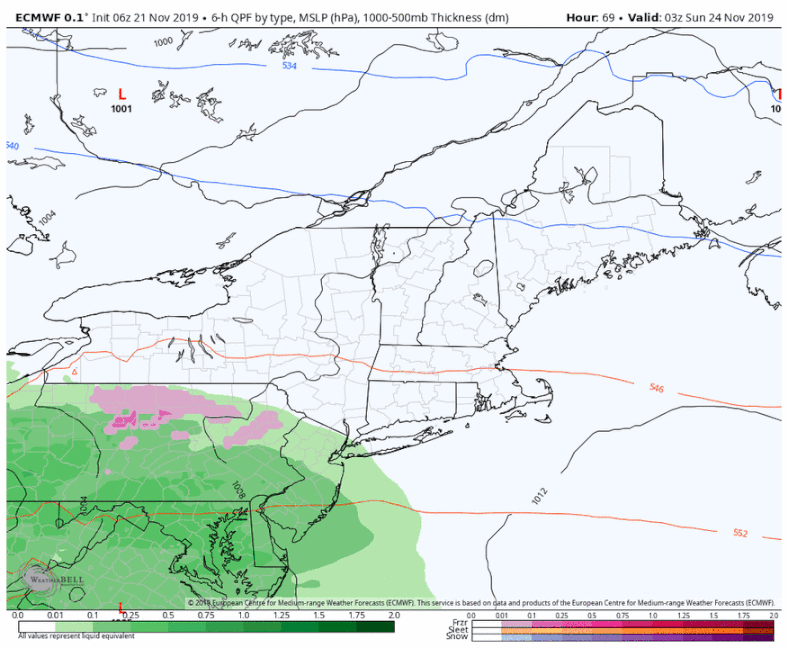 |
| 06z ECMWF run |