After a stint as the worlds strongest tropical cyclone this year so far, Typhoon Soudelor underwent an Eyewall Replacement Cycle (EWRC), allowing dry air to become entrained within the system. However, the storm seems to have overcome this problem and is rapidly reorganizing as it heads into warm waters around 30 degrees C and a favorable environment for intensification. It is forecast to chug west north westwards first through the heart of Taiwan, then into China. If it re intensifies, Soudelor could impact Taiwan as a category 4, or worse. Even if it does not, a category 3 strike would be quite damaging. Due to its mountainous terrain, extreme rainfall is common during typhoons as tropical moisture gets wrung out of the atmosphere. Landslides are common and flooding is likely.
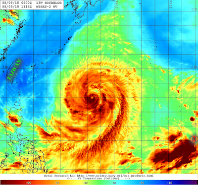 |
| Water vapor image of Typhoon Soudelor showing excellent (near perfect) upper level outflow structure. |
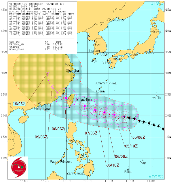 |
| JTWC Forecast bring the typhoon right through the center of Taiwan |
Although the storm is forecast to landfall dead center on Taiwan, Souledor is a large storm that will affect the whole island. That being said, the exposed eastern coast of the island is sparsely populated and the populated centers of Taipei and Kaohsiung are at the northern and southern tips of the island, respectively. Taiwan is commonly affected by typhoons and so its infrastructure has been engineered to withstand the forces of the storm. However, a strong typhoon will still be very damaging.
 |
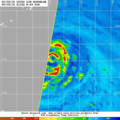
| The typhoon is currently attempting to expel dry air from the core and rebuild its eyewall and begin the restrengthening process as it enters a more favorable environment. |
 |
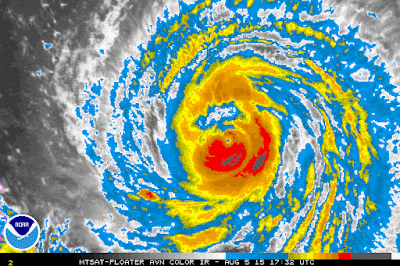
| Soudelor had a break in the SE side of the eyewall due to the EWRC and because of dry air. This caused the storm to weaken to a Cat 3 with 115 MPH winds |
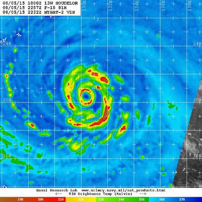 |
| A couple of hours later, the eyewall has been closed, IR satellite imagery (animation above) shows an increase of convection at this time too, signalling that the storm is strengthening and reorganizing. Notice how outside the eyewall, the convective bands seem to be forming a loop, when this loop closes, the storm may undergo another EWRC, hopefully before landfall. |
Landfall on Taiwan is a blessing to China, which is less well prepared since the mountains will disrupt the storms circulation, significantly weakening the storm before it drifts into China. This storm will be closely watched as it approaches land over the next 48 hours-enough time for the storm to change drastically.


