5:48AM Update
brrrrr.... It's 1.5 degrees here... cc..c.ccold..
11:30 PM Update
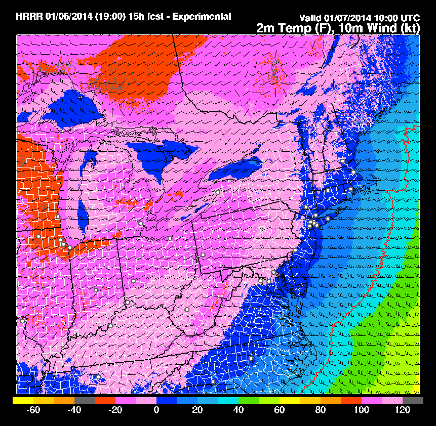
Temperatures have hit the forecast lows for the night at 6 degrees. There is still 7 more hours of cooling to go. Models continue to show temps near zero as a low tonight.
10:10 PM Update
DCA is running 6 degrees below forecast at 15 degrees. The forecast temperature for 10:00 was 21 degrees. 8.5 degrees at my house with a windchill of -7
7:04 Update
Random fact: DCA has dropped 6 degrees in the past hour to 26 degrees
Entering a very tight temp gradient.

ORIGINAL TEXT:
After a high of 49 at 7:52 AM at DCA, the temps have plummeted following a passing cold front. Now this is a true Arctic Cold Front which is not something to be taken lightly. For the past 3 hours, the temperature at DCA has dropped 2 degrees per hr... That is some impressive cold air advection. The rapidly dropping temperatures combined with winds up to 35MPH have resulted in numerous windchill warnings and advisories across the area. Temps will continue to plummet tonight and early tomorrow morning to the single digits and quite possibly below 0 in the colder regions. Windchills will range from -10 to -20 at times. Tuesday highs will only be in the teens. However brutal the cold is, it will not last. Temperatures will moderate after tuesday for the rest of the week and a warmer, wetter pattern will emerge for the next week.
 |
| The RAP model temp forecasts have been running about 1 degree C below average for the East signalling the potential for colder than expected temps. The cold windchill factors have prompted school closures and delays throughout the area, with 2 exceptions, DC public schools and Montgomery public schools. I think this is a very hazardou moves by the Mcps. At least DC is located in an urban heat island and is offering to open the schools early to let in the children from the Cold. Mcps is only on the other side of the river from Loudoun County, which has closed schools. However, they are at a higher elevation. Making students wait for buses in the 0 degree cold is not exactly safe. I hope they realize this and revert to a 2hr delay or a closing. (obviously as one of the students who have to ride the bus tomorrow I would think this... ) |


No comments:
Post a Comment